
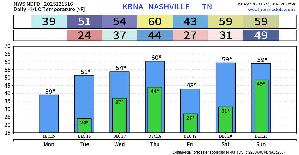
We’ll finally return above freezing today after ~36 hours of below freezing temps. High temp of around 40° certainly isn’t warm, but it’s improvement.
We’ll gradually warm up over the next several days, even making it all the way to 60° for a high by Thursday, leaving the near 0° wind chills in the past.
A few showers will be possible during the day on Wednesday, but these would be light and quick.
The real rain chances come around on Thursday afternoon-ish, when a cold front pushes thru and should give everyone some decent rain. Models are still showing very little to no storm fuel available, so severe weather is still not a concern. This could change, but for now, all models are in good agreement that this just looks to be some rain right now. Rainfall totals generally around 0.5-0.75″ are expected.
That cold front will be the reason high temps only make it to the low 40s on Friday. Thankfully, we recover quickly as highs return to near 60° for Saturday and Sunday – but we’ll also have low to medium rain chances to deal with those two days as well.
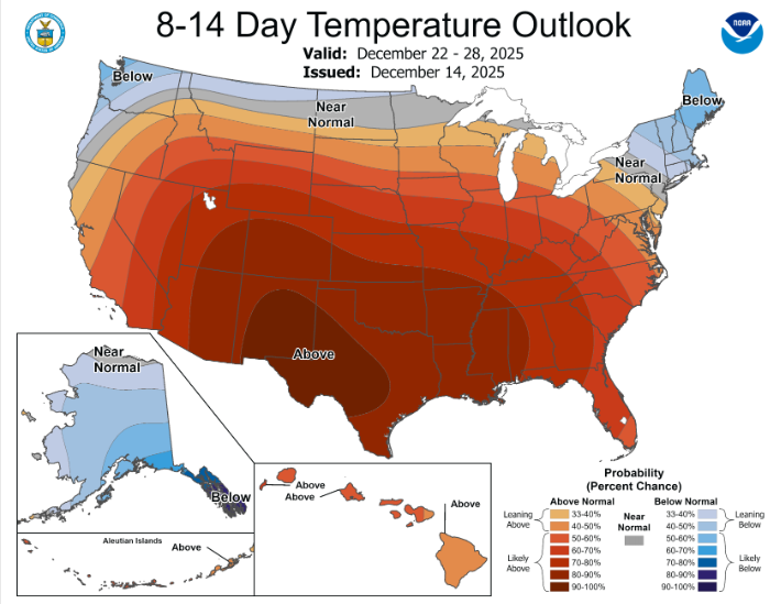
Above-average temperatures are still likely to stick with us thru the Christmas holiday. Long-range models indicate that highs near 60° will hang around for a while. Our chances of a White Christmas are always very low, but it’s safe to say that chances this year are ~0%.
Categories: Featured Blog