
If you haven’t been outside today – it’s cold. Don’t let the sun fool you. Wind chill values (aka “feels like” temps) will be near the single digits all day. If you need to go outside today to do anything, be sure to have several layers on, hypothermia can set in quickly with this kind of cold.
The “official” low tonight is 12° but that’s Nashville, most everyone outside of Downtown will easily reach single digits. Several layers will certainly be needed as you head out the door Monday morning. Our Cold Weather Advisory continues thru noon Monday. Continue to be mindful of the 4 P’s: People, Pipes, Pets, and Plants.
We finally make it back above freezing around midday Monday. We’ll also be treated with a gradual warming trend this week, even making it back to 60° on Thursday.
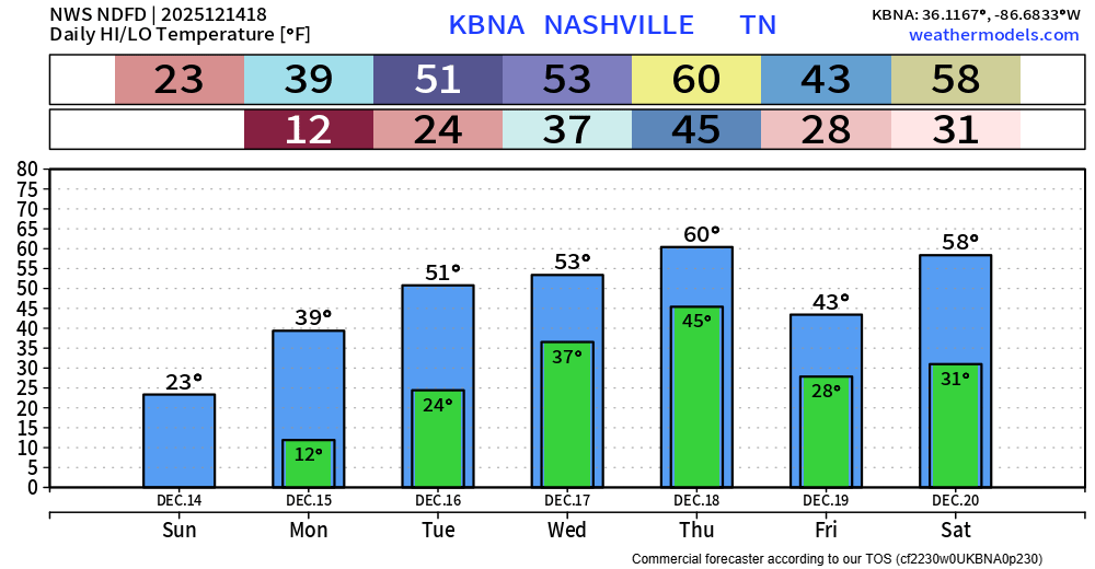
Low rain chances return Wednesday morning, not expecting much, if anything, from this.
Much higher rain chances return Thursday – when most of us will likely see some decent rain. Models are suggesting a ton of wind energy available – pretty typical for this time of year. A few runs have suggested some very, very low instability levels. Right now, not expecting anything strong or severe, but it’ll be something we keep an eye on throughout the week.
Categories: Featured Blog