
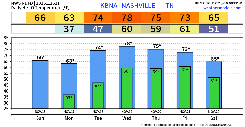
Monday will be the last day without any rain chances for a while, as we enter a wet (and warm) pattern.
Rain chances return Tuesday PM and will stick around daily thru the end of the week. Models are still disagreeing with each other on timing, so I’m hesitant to start giving out any specifics on that just yet.
Highest rain chances still look to be in the Thursday/Friday timeframe, when the heaviest rain is possible.
Those with outdoor plans should keep an eye on the forecast, we’ll be able to give out specifics on timing and such soon when the high-res models come into range.
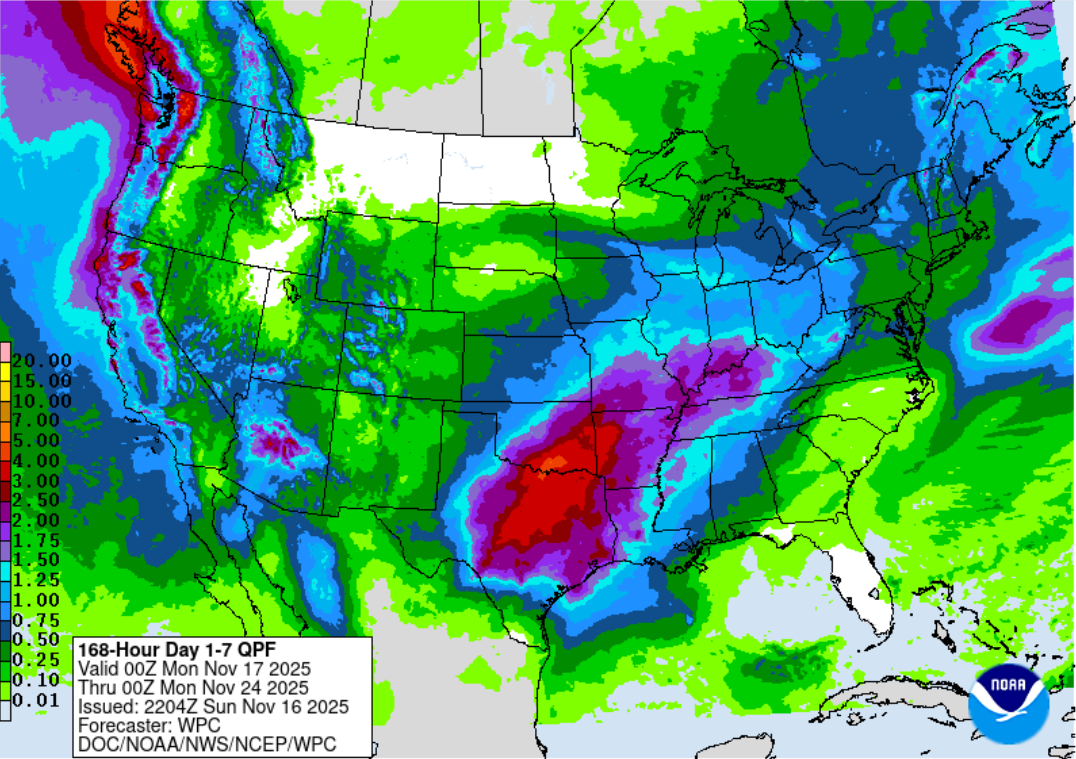
“The severe weather and flooding threat with the system continues to look minimal as instability is very low and the higher rain totals are expected to stay west and north of Middle Tennessee.” – NWS Nashville Area Forecast Discussion
As noted in the quote above from the great minds at NWS Nashville, heaviest rainfall totals over the next 7 days will likely be well to our west.
Temperatures continue to stay above-average, even well above-average by the middle of this week as highs peak in the mid to upper 70s. We’ll have a few cool mornings to start of the week, but lows will only get down to 60° later this week. Certainly not middle of November temps.
Categories: Featured Blog