
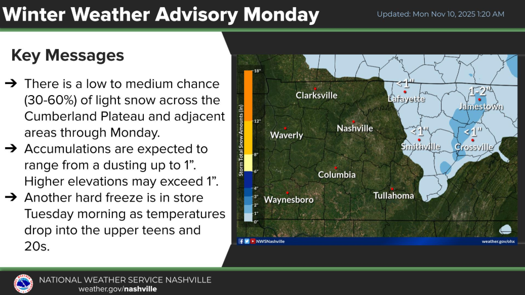
A few lucky folks have already seen more snow flurries this morning, with more expected throughout the day. However, with temps expected to be above freezing (BNA is already at 33° as of 9a) any flurries will melt on contact with the ground – no accumulation is expected. Per usual, the Plateau will see some accumulation.
We’ll get a hard freeze tonight as temps fall into the low to mid 20s. Wind chill values will again be near 15° as you head out the door Tuesday morning – layers will be needed.
These temperatures by themselves aren’t anything too noteworthy – if it were January, it would hardly be worth mentioning since these temperatures are common then. However, it’s early November, and these low temps will be ~15° below average.
You’ll be able to forget where you put your winter coat by late this week. Temperatures will quickly rebound throughout the week, and even being near freezing will be an afterthought. High temps by Friday will return to the low 70s we saw last week.
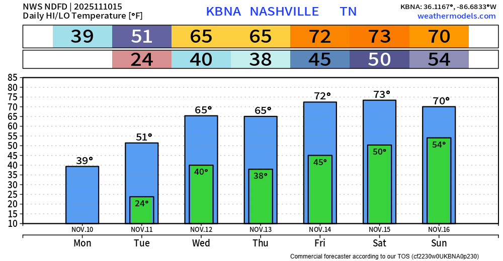
No rain chances in the forecast until Sunday. Outdoor plans on Friday and Saturday are encouraged.
Categories: Featured Blog