
Yesterday our high was 75°. Tomorrow morning it will feel like ~15°. Quite the flip of a switch.
Our cold front has moved thru, which has already brought in cooler and drier air thanks to a strong NW breeze.
We could see a quick rain shower this afternoon – nothing that should alter any plans.
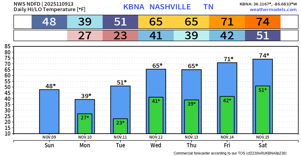
Temperatures will plummet tonight down in the mid 20s. That paired with a cold breeze from the NW will send wind chill values near 15° as you walk out the door Monday morning.
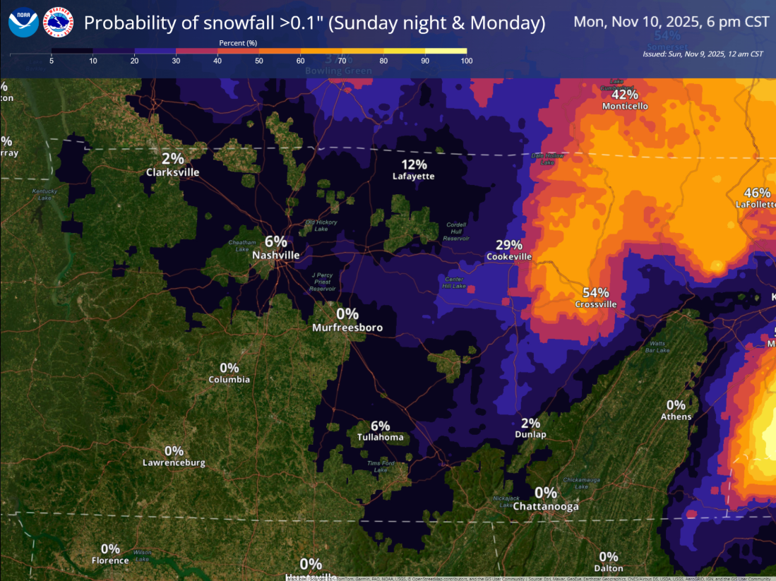
The possibility of seeing some flurries during the day on Monday still exists – but no accumulation or impacts expected. They’ll be cool to look at falling but will melt on contact with the ground.

If you would really like to see accumulating snowfall, head over to the Plateau – they may see around 0.5″. Otherwise, we’ll have to wait our turn here.
Tuesday morning will be another bitterly cold one, with lows near 20° and wind chills yet again near 15°. Layers will be needed.
Those very cold temps will quickly be forgotten as high temps return to the mid 60s by Wednesday, all the way back up to the low 70s by Friday. No rain chances until next Sunday-ish.
Categories: Featured Blog