
Similar to yesterday’s blog, I do want to address today’s lovely weather before we dive into the severe talk – because nice weather deserves attention too.
High temps will surge into the low 70s today. Local high school teams that moved their playoff games up to today will be treated with nice weather. Temps near 60° by kickoff, mid 50s by the end of the game.
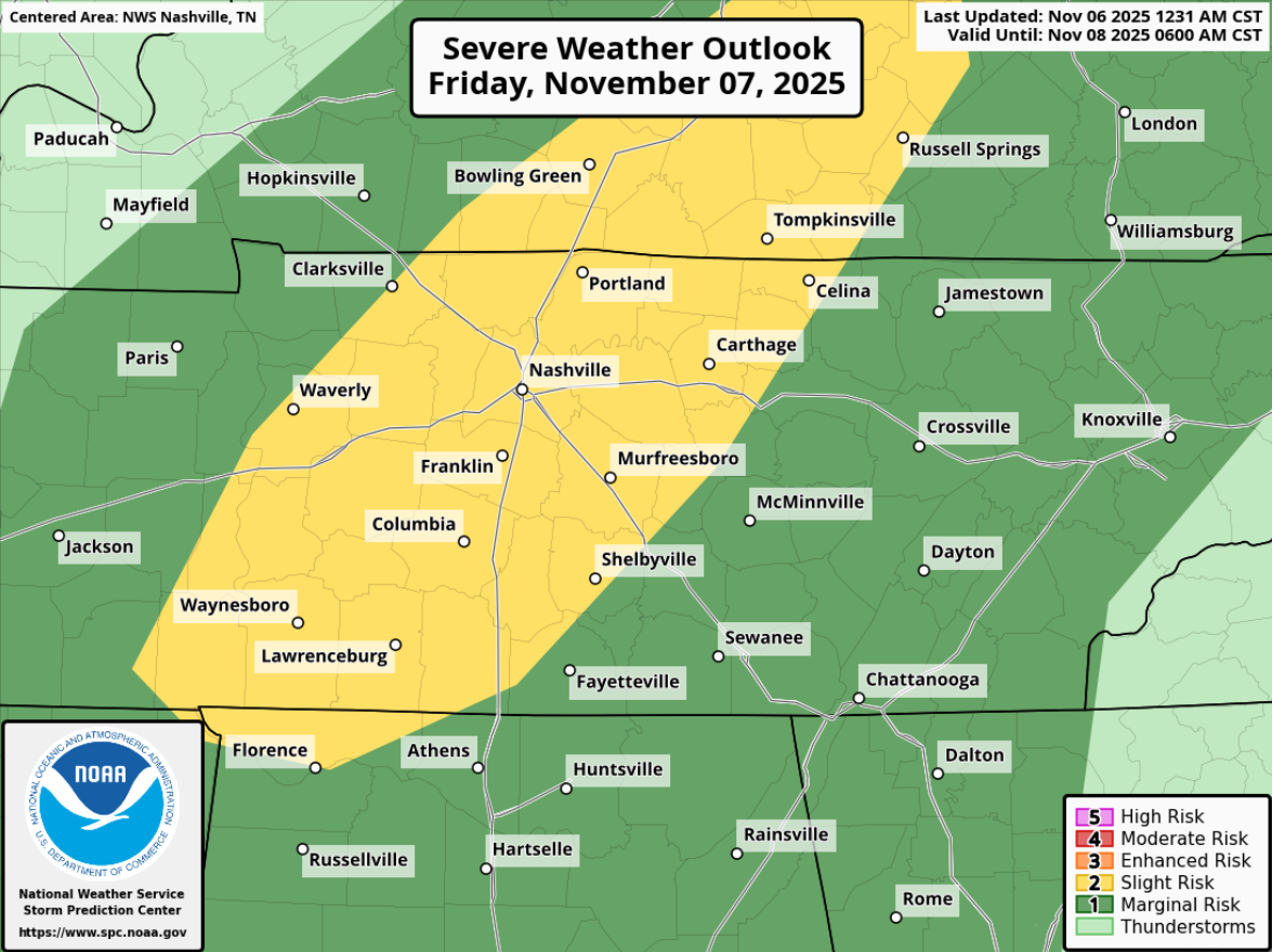
In short: we have a low-end severe threat Friday afternoon and evening. The main threats will be damaging straight-line winds and hail, but a tornado cannot be ruled out. There’s still some uncertainty that exists. Stay connected for future updates! The rest of the blog below contains a lot more details, if you please.
While uncertainties regarding the overall threat remain, expected impacts remain the same.
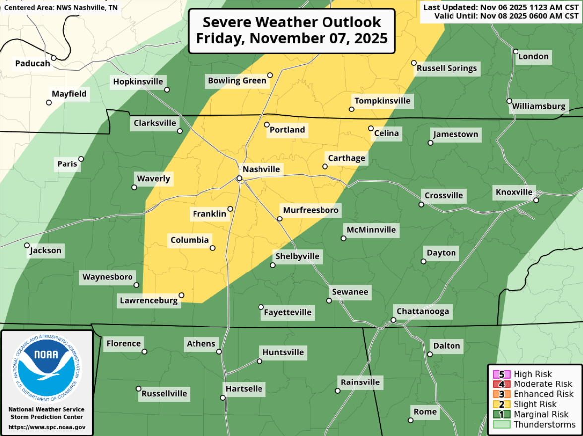
The Storm Prediction Center has our two counties outlooked with a: 15% chance of severe hail (1″+), 5% chance of damaging straight-line winds (58mph+), and a 2% chance of a tornado – all within 25 miles.
Essentially, the main threats will be damaging straight-line winds and hail, but a tornado cannot be ruled out.
Timing:
After looking at several models, I think a reasonable timeframe for storms on Friday is 1p-6p. This of course, could change.
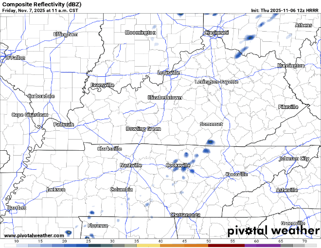
Looking at the HRRR model (a decent model, but again very, very far from perfect), it shows storms firing off just to our N, if not right on top of us Friday afternoon. This is one solution, but not the truth.
The “Why”/Uncertainty:
You may think that HRRR model run looks kinda unimpressive – and I wouldn’t totally disagree with you.
Bear with me here, below will have some real nerdy talk – but I’ll go thru it.
“Ahead of this front, a warm, moist airmass will yield around 500 J/kg of CAPE primarily across the western half of Middle TN. This will allow for showers and thunderstorms to develop late morning before becoming more numerous in the afternoon and early evening hours. There`s still a lot of uncertainty regarding tomorrow`s severe weather risk as some parameters still aren`t favorable. While there`s plenty of wind shear with bulk shear values exceeding 50 knots, forcing looks to be weak with the shortwave too far north and the front`s arrival too late.” – NWS Nashville Area Forecast Discussion
Less nerdy translation: tomorrow we’ll have enough storm fuel (not a lot tho), with decent shear (winds changing with speed and direction with height), pretty meh but sufficient moisture to support strong to severe storms. However remaining uncertainty is if we have something to provide enough lift to get storms going. No lift = no storms.
Tomorrow we’ll be watching if that lift to get storms going does arrive, along with some other variables. More data will be coming in up until the event starts and we’ll be watching and keep y’all posted.
What To Do:
November marks the beginning of our “second severe weather season” – so this isn’t unusual.
Those with outdoor plans tomorrow afternoon and evening should especially keep an eye on the forecast. Those in charge of outdoor plans should make a plan B that involves being in an enclosed building during this timeframe. Regardless of if the storms do reach severe criteria, they will likely contain lightning.
I know several local HS teams still are planning on playing their playoff game on Friday. The good news is that currently models think most of the activity should be out of here by 7p or so. This could change, but I remain hopeful.
This remains a low-end threat – with an 85% chance you don’t see severe weather within 25 miles of you. Along with a 98% chance you don’t have a tornado occur within 25 miles of you. I like those odds, but that does not mean you should dismiss the threat. Now is a great time to refresh yourself on what to do if a warning is issued for you, we have an article here that covers all that: What To Do | Nashville Severe Weather
Any talk of severe weather isn’t fun. I’d much rather talk about snow or sunny and 75°. However, we live in Middle TN and we see all kinds of weather. We have a great article here to help with storm anxiety: Taking Care of Storm Anxiety | Nashville Severe Weather. Take care of yourself!
As always, we’ll keep y’all updated on all the new information that comes in on all of our socials (X/Threads/BlueSky). Stay connected!
Saturday during the day will be great. Dry with highs back in the low 70s. We could see some showers return Saturday night along a cold front that is the culprit of our approaching cold temps.
On Sunday, it’s likely our high temperature occurs right around midnight. As the cold front moves thru, our winds will start to come from the NW bringing in much colder and drier air.
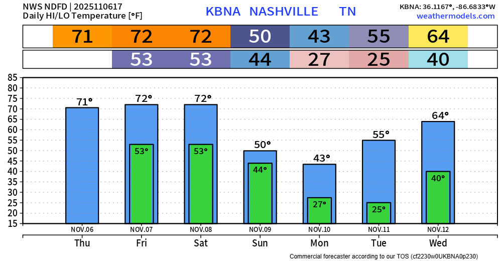
Monday and Tuesday morning we’ll have the coldest temps of the season so far. Everyone will see a hard freeze with lows dipping into the mid 20s.
The Euro model has been pretty consistent with thinking we see some no-worry-flurries on Monday during the day. No-worry as in we are not expecting any accumulation or any impacts. If you are lucky enough to see some flurries, they will melt on impact with the ground. No need to go stock up on milk and bread. Also want to note, the GFS is anti-flurries and keeps us dry.
Temps will rebound pretty nicely by the middle of next week.
Categories: Featured Blog