
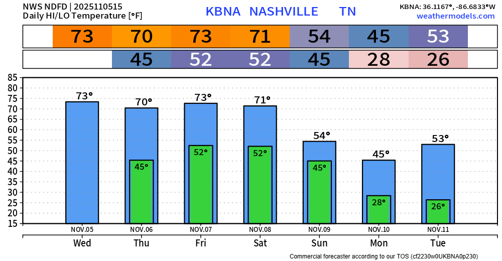
Before we hop into the severe weather talk, I do want to mention that today and Thursday will both be lovely days. High temps near 70° – which is nearly ten degrees above average. Plenty of sun, nice treat for early November.
For the past several blogs, we’ve been talking about the potential for strong to severe storms on Friday. We also discussed the question marks floating around and all the uncertainties regarding this risk. While there are still uncertainties, there is now more confidence.
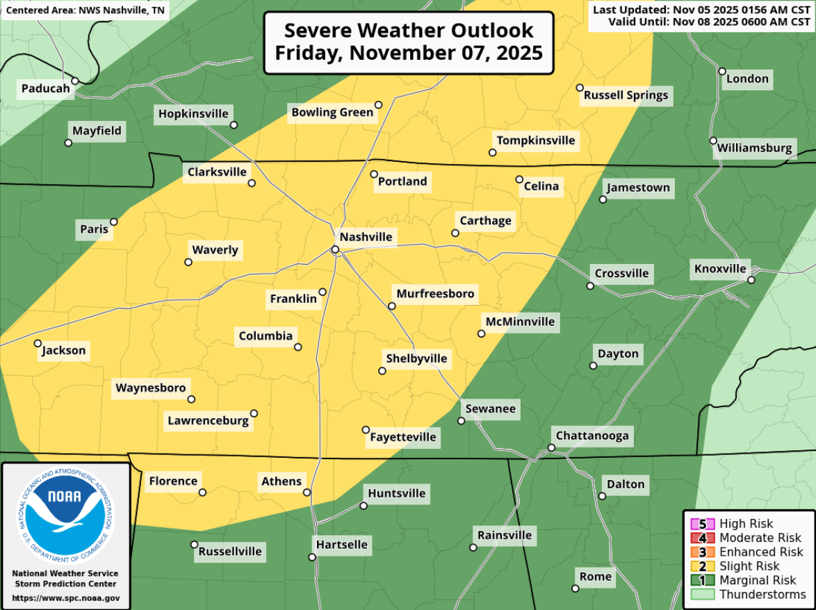
Enough confidence for the Storm Prediction Center (SPC) to outlook both of our counties with a 15% chance of severe weather within 25 miles for Friday. All modes of severe weather appear possible, with damaging straight-line winds and hail being the main threat, but a tornado cannot be ruled out.
Timing:
Friday afternoon and evening currently looks like the timeframe for severe weather potential. This could certainly change.
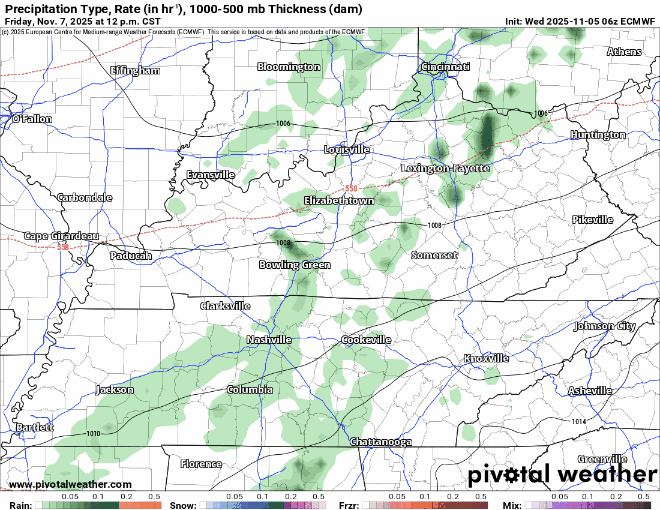
While we are still out of range for the HRRR model (a favorite, but so very far from perfect model), we have the insight from a few others. I think the NAM 3k, another high-res model, has been out on a pedal tavern, then went to Broadway and continued the party – so I won’t show it.
So for now, I’m left with the global, low-res models. I’ll show the Euro model – not for the sake of details, but just to show the general thinking on timing. I will note, that this is slightly faster than some other model solutions.
The “Why”:
“…more probable severe-storm development appears to be centered from south-central KY across the TN Valley. This corridor should have a better opportunity for weak to modest destabilization, where strong deep-layer shear and hodographs would favor supercells.” – Storm Prediction Center discussion.
In less nerdy terms, severe storms will be possible thanks to storm fuel (although there won’t be a lot of it, good news) and sufficient shear (wind speed and direction changing with height).
Following up on that good news, models continue to think there will be some, but not much CAPE (storm fuel). The other good news is that the low-pressure system is expected to be all the way up in Canada. In an ideal setup for severe weather, you’d want the low-pressure system much further south for the best moisture return, low-level winds. This will be something to watch, and details will continue to be sorted out as more data from high-res models comes into view.
What To Do:
Severe weather setups like this are far from uncommon this time of the year. November is really the start of our “second severe weather season” – although it’s possible anytime of the year here.
With the timing of this being Friday afternoon and evening – it’s certainly far from ideal. Many will have outdoor plans, including high school football playoffs beginning.
Those with outdoor plans should start thinking about a plan B, which would include plans being in an enclosed building. High school football games could very well be affected by storms, those in charge should go over safety plans and other options. I know a few have already moved games to Thursday, which would be ideal in a perfect world.
This is a low-end threat, and currently there is a 85% chance that severe weather doesn’t occur within 25 miles of you. Good news, but not a reason to disregard it. With us entering our second severe weather season, it’s a good time to dust off the cobwebs and refresh yourself on what to do if a warning is issued for you: What To Do: Nashville Severe Weather.
The talk of severe weather can get some heartrates up, understandably so. We have an article here on storm anxiety.
Bottom line – stay connected for future updates! Info may change between now and Friday.
Saturday during the day looks dry and warm, with maybe some showers at night, but those chances continue to look low.
We’ll see our coldest temperatures so far this season Monday and Tuesday – when we’ll all likely see a hard freeze with lows in the mid 20s. More on that later.
Categories: Featured Blog