
We have very quickly warmed up from the mid 30s this morning, with BNA sitting at 70° at the 1p observation.
High temps near 70° will be common thru Saturday, nearly 10° above average for the start of November.
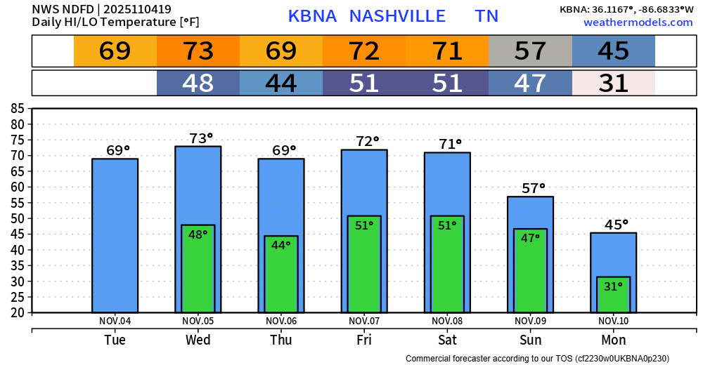
Our next rain chances arrive on Friday PM – with there still being plenty of question marks.
Some models are suggesting that we could see enough shear and CAPE (storm fuel) to support a low-end threat for strong to severe storms.
“What`s holding me back from being more confident in severe weather on the weekend is lack of support from mid-range CAMs [Convective Allowing Models] (not in range yet temporally), the distance between the low pressure center and the front (Low is forecasted to be back in Canada by Friday morning), and moisture return in the warm sector. These questions can be answered once more CAMs grab a hold of this system and its dynamics, which will be in the next few days.” – NWS Nashville AFD.
All of these questions marks are expected with the event still being several days out, and these questions will likely soon be answered over the next couple of days as the high-res models come into range.
For now, enjoy the warm afternoons and keep an eye out for updates, especially those with outdoor plans Friday afternoon and evening.
Saturday during the day looks dry, with maybe some showers at night, but models are currently not impressed with these chances.
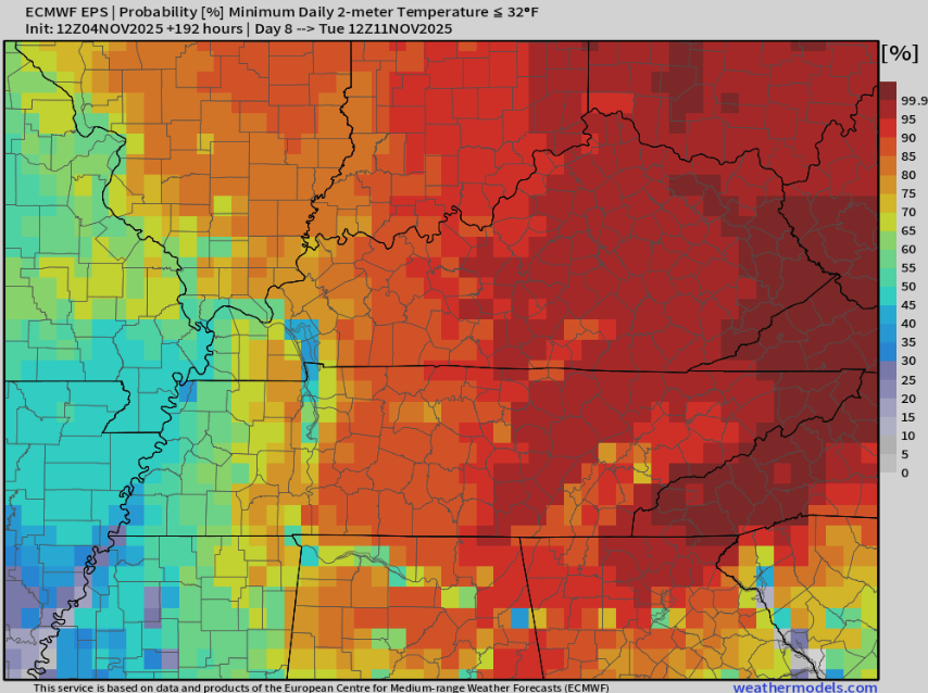
Following that, our coldest air so far this season is expected next Monday/Tuesday. Models suggest we will all fall below freezing, possibly seeing our first hard freeze (<28°).
The Euro ensemble puts our chances at dropping below freezing Tuesday morning at ~80-85% – a pretty solid signal this far out.
Categories: Featured Blog