
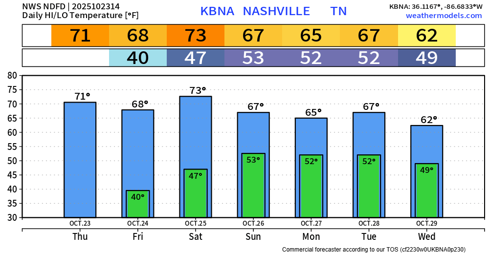
Ideal weather happening thru Saturday.
Tonight will be the coldest night so far this Fall, with lows falling to the upper 30s in some spots. Maybeee a few rural spots see some frost, but regardless, you won’t see any Freeze Products issued for the remainder of this year due to growing season being largely over with.
Temperatures will warm up each day. Just really nice weather for today, Friday, and Saturday – for all those with outdoor activities planned.
Rain chances return Sunday thru Wednesday-ish.
Highest chances during this time will be Sunday midday thru Monday morning, and again Tuesday morning thru Wednesday morning. It won’t rain the entire time, this is just when chances are highest. These are also rough timeframes, models are still a little confused on the exact timing of things.
Models are in agreement that severe weather is not a concern, really not even worried about thunderstorms either – just some showers bringing some rain.
Rainfall totals generally around an inch thru Wednesday, some will see more, some will see less.
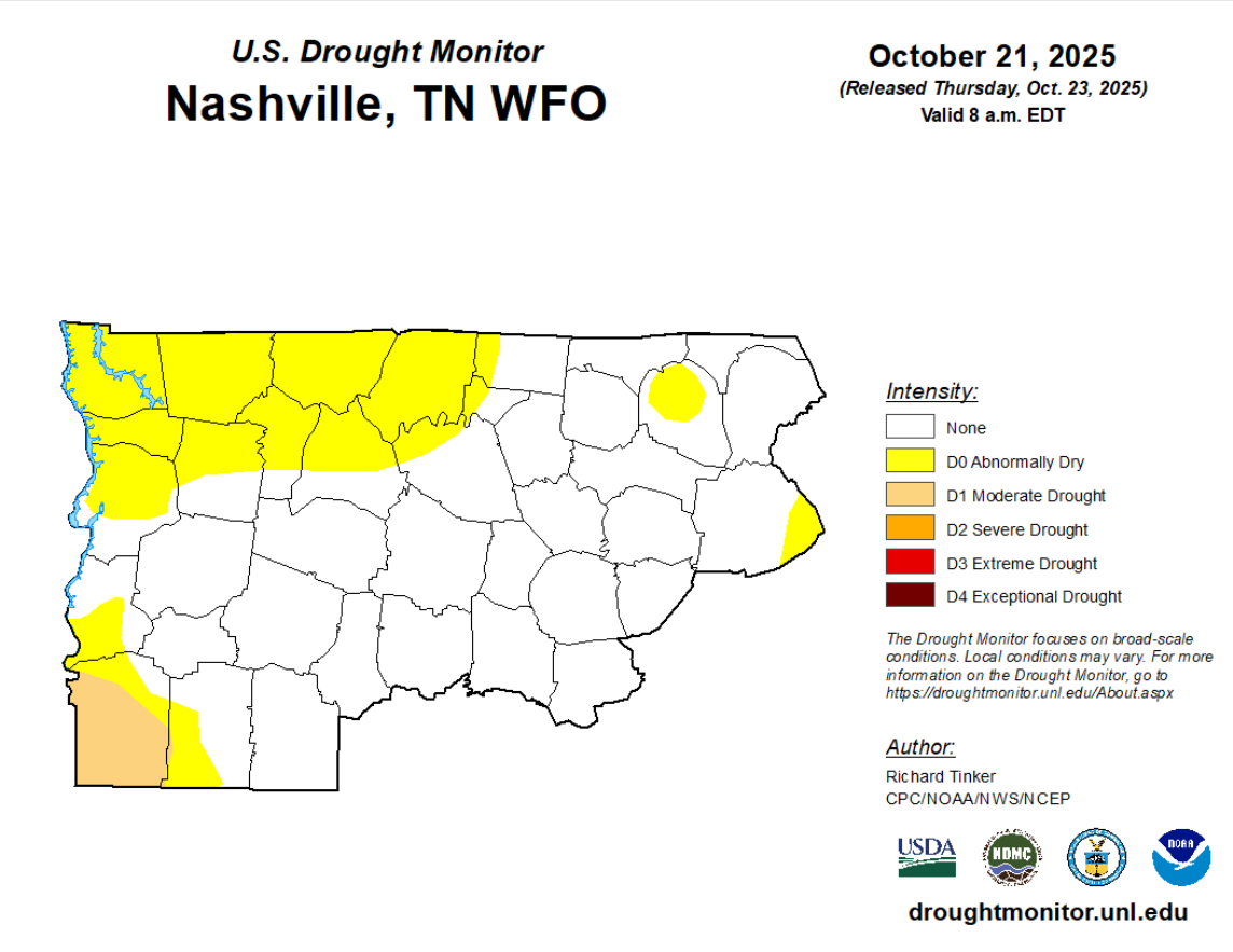
New Drought Monitor came out today and shows that both of our counties are drought-free. The northern half of Davidson Co. is still under the Abnormally Dry category, but that doesn’t count as drought. This may be completely removed after this upcoming rain.
Categories: Featured Blog