
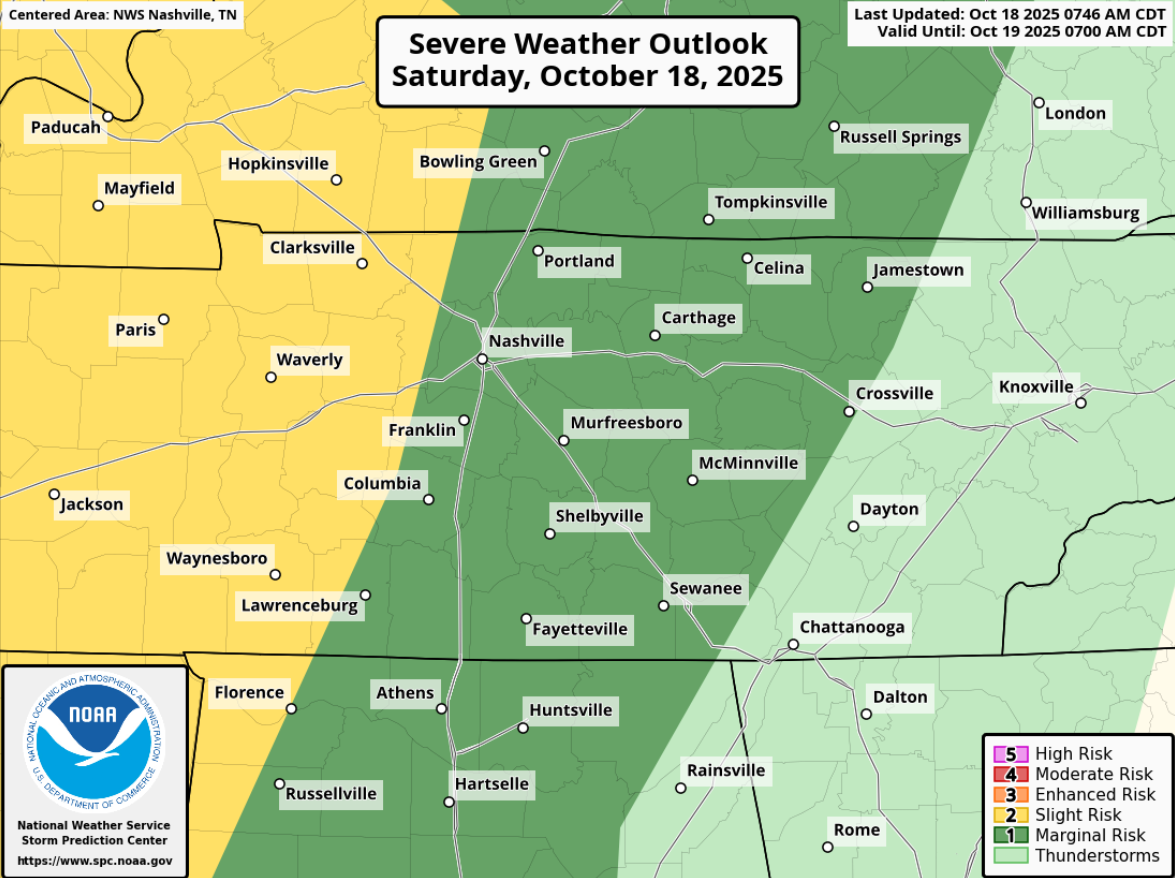
Summary: A weakening line of storms will arrive roughly between midnight – 2a, carrying a low chance of damaging straight-line winds, and a very, very, very low chance of a brief tornado. We’ll be following this the whole way thru.

Storm Prediction Center continues to have us outlooked with a 5% chance of damaging straight-line winds and a 2% chance of a tornado, within 25 miles. Yes, those are some lowww odds, but they aren’t zero.
The reason that the higher probabilities are to our west is that instability levels (storm fuel) are expected to drop off a cliff as the storms approach I-65. CAPE values won’t be zero, and we’ll have some decent shear in place, so it’s still worth keeping an eye on. But my other eye will be watching the great slate of college football today.
Timing:
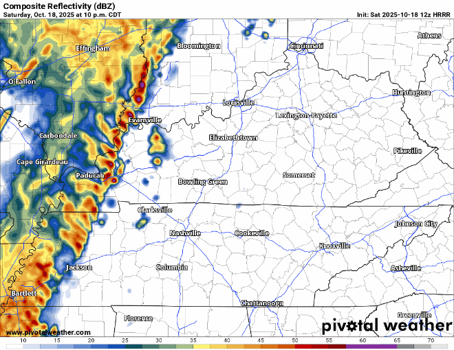
Expected ETA has shifted back just a tad; line of storms is now expected to arrive sometime between midnight and 2a Sunday.
HRRR model gives a guess, and it’s been fairly consistent on this:
- With this being an overnight threat, even with it being a very meh threat, have a way to wake up if a warning is issued for you (NOAA Weather Radio, Wireless Emergency Alerts on your phone, wake-me-up app). Even though the likelihood of you getting a warning tonight is quite low, it’s still good to have that refresher with our second severe weather season coming up.
- We’ll be posting updates as needed on all of our socials all day (and night), and will go live on YouTube if a warning is issued for any portion of our two counties
- This will also have some decent rainfall, 0.5 – 1″ expected – we avoid any flooding issues
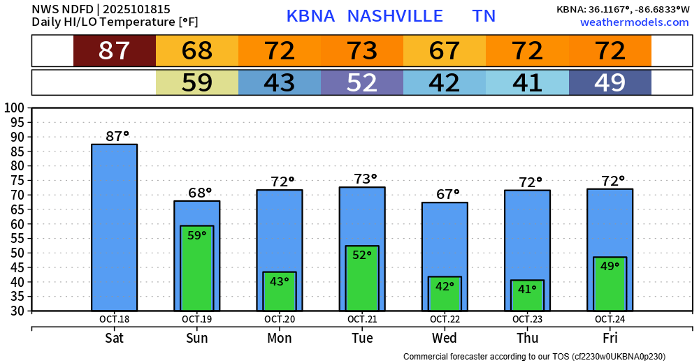
Few leftover showers may linger around for the Titans game on Sunday for Vrabel’s return.
Side note, 87° is our daily high record for October 18, we’ll be right around it today.
Seasonal temps, with the coolest mornings so far this Fall are in store for next week. Probably the definition of Fall weather.
Categories: Featured Blog