
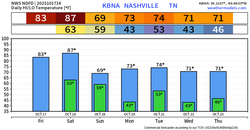
Today will have good weather. Saturday during the day will be dry but hot, we’ll be close to a daily record high.
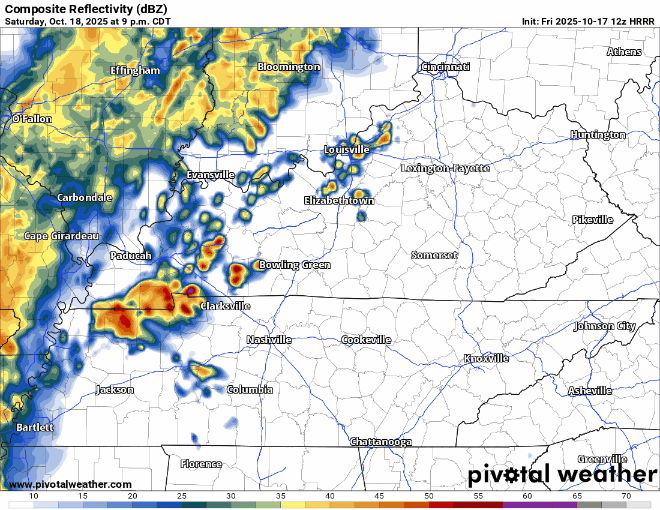
Saturday evening our attention will turn towards an incoming cold front that will bring some showers and storms to the area.
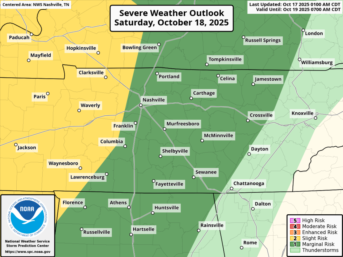
Severe weather cannot be ruled out Saturday night. The SPC says 5% chance of damaging straight-line winds and 2% chance of a tornado within 25 miles – these probabilities could change, higher or lower.

Timing:
Current ETA is midnight – 3a Sunday – subject to change, but models have been fairly consistent on that window.
A few thoughts:
- The main threat will be damaging straight-line winds. Models are in agreement that there will be very little (if any!) CAPE (storm fuel) to work with – good news. However, the tornado threat is non-zero, but very low.
- This is an overnight “event” – have a way to wake up if a warning is issued for you. NOAA Weather Radio, Wireless Emergency Alerts, wake-me-up app on your phone. Even if you don’t get a warning, this is still a good reminder that our second severe weather season is quickly approaching, and you should review your plans on what to do if a warning is issued for you.
- It is entirely possible that this line is a whole bunch of nothing, but don’t let this low-end threat sneak up on you. Better to be prepared than not.
- We’ll be posting on all of our socials as needed, and as always, will go live on YouTube if a warning is issued for any portion of our two counties.
We’ll probably have a few lingering showers on Sunday morning, but the Titans game should be mostly rain-free.
Average temps will accompany us thru the beginning of the next week, with maybe some meh rain chances by the middle of the week. That’s some Fall weather.
Categories: Featured Blog