
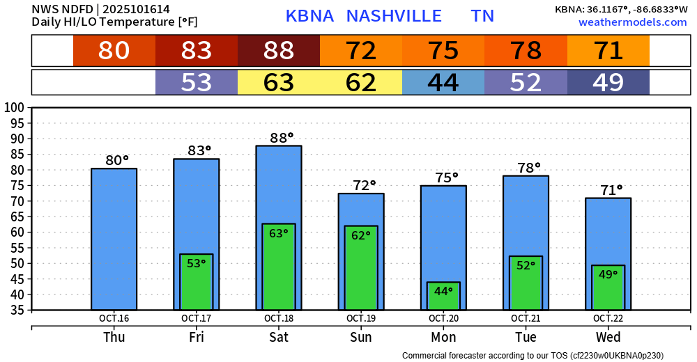
Today, Friday, and Saturday during the day will be warm and dry. Saturday’s current forecasted high is 88°, which would be a new daily record.
Overall thinking for our Saturday night/Sunday morning “event” remains generally the same.
Brief summary: A cold front will move thru sometime Saturday night/Sunday morning, bringing some showers and storms along with it. While no severe weather is currently expected, a storm or two could be strong with gusty winds.
The Storm Prediction Center continues to exclude us from any severe probabilities.
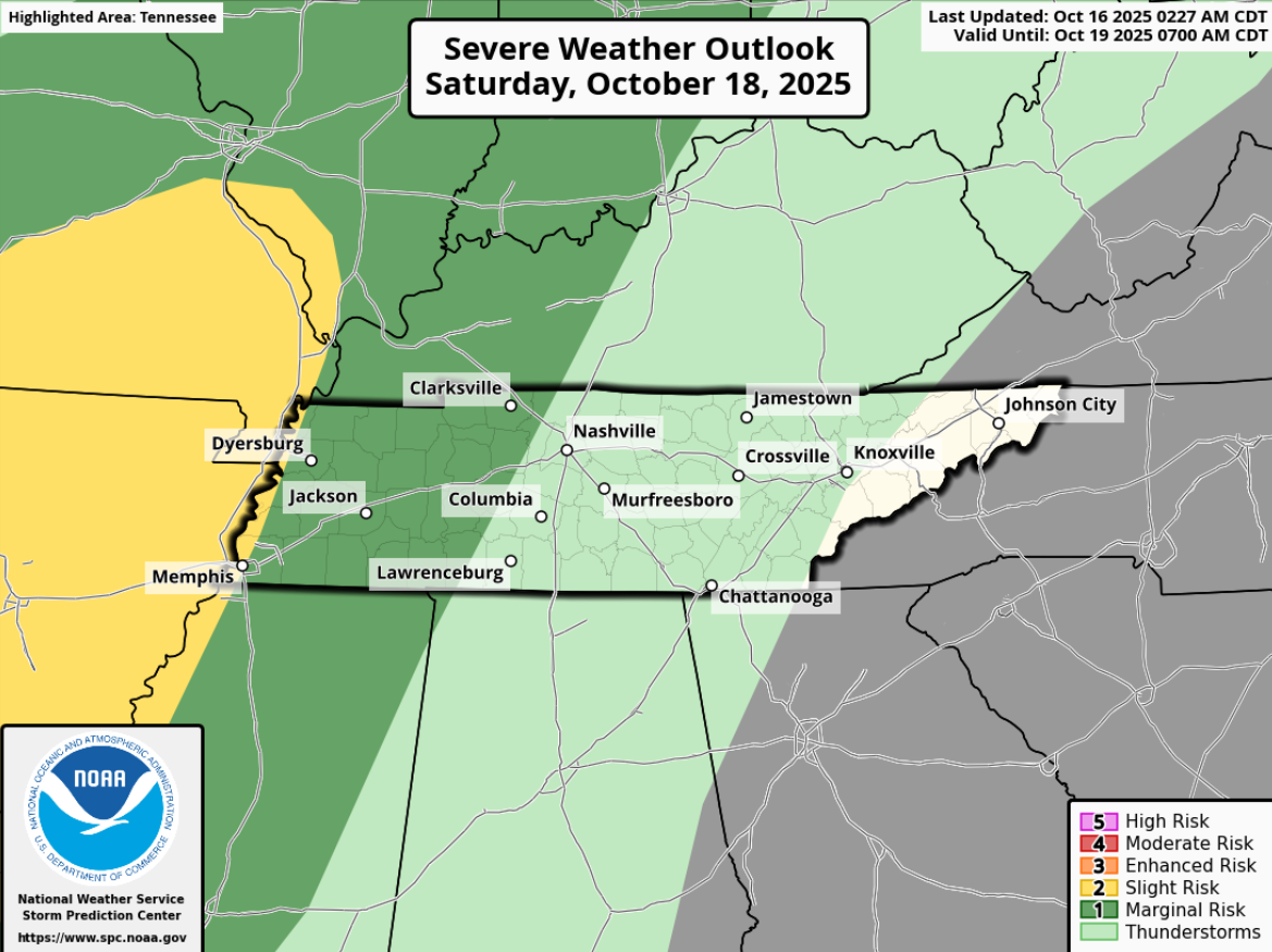
Models continue to think there is very little CAPE (storm fuel) available as the storms roll thru. There will be some decent shear available, which could lead to a few storms having some gusty winds, but the chance for any severe weather is very, very low. Not currently worried about tornadoes.
Timing:
It still appears that your plans Saturday during the day, and even your dinner plans should be dry.
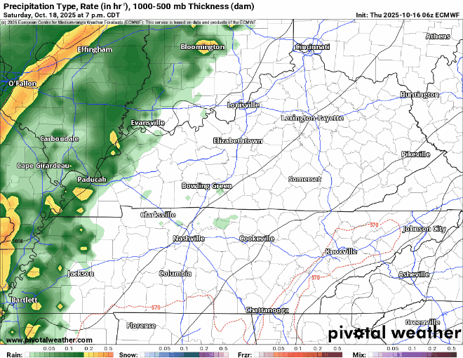
Models continue to show the line of showers/storms arriving sometime between 9p Saturday – 2a Sunday (subject to change).
The Euro model shown below gives a rough idea of how things could play out:
The general consensus is that rain will move out in time for kickoff for the Titans game.
Temperatures following the passage of the cold front will be much closer to average for the middle of October. Monday morning will be the coolest morning of the season so far. Low rain chances return middle of next week.
Categories: Featured Blog