
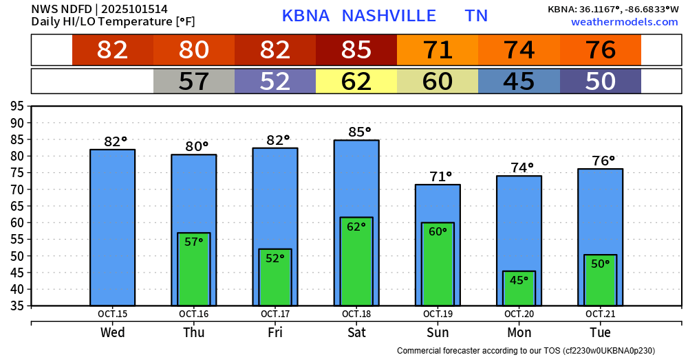
This work week continues to be nearly a copy and paste. Cool mornings, warm afternoons and dry. I’ll skip to the “interesting” part – but things aren’t really that interesting.
A cold front is still expected to bring showers and storms thru the area sometime late Saturday into Sunday. Overall thinking on this system remains the same, although there may be a little more clarity on the timing now.
Thinking on the severity remains largely unchanged.
Both the Colorado State Machine Learning Probabilities (left) and the Storm Prediction Center (right) continue to exclude us from severe probabilities. These two are in some pretty solid agreement, which increases confidence.
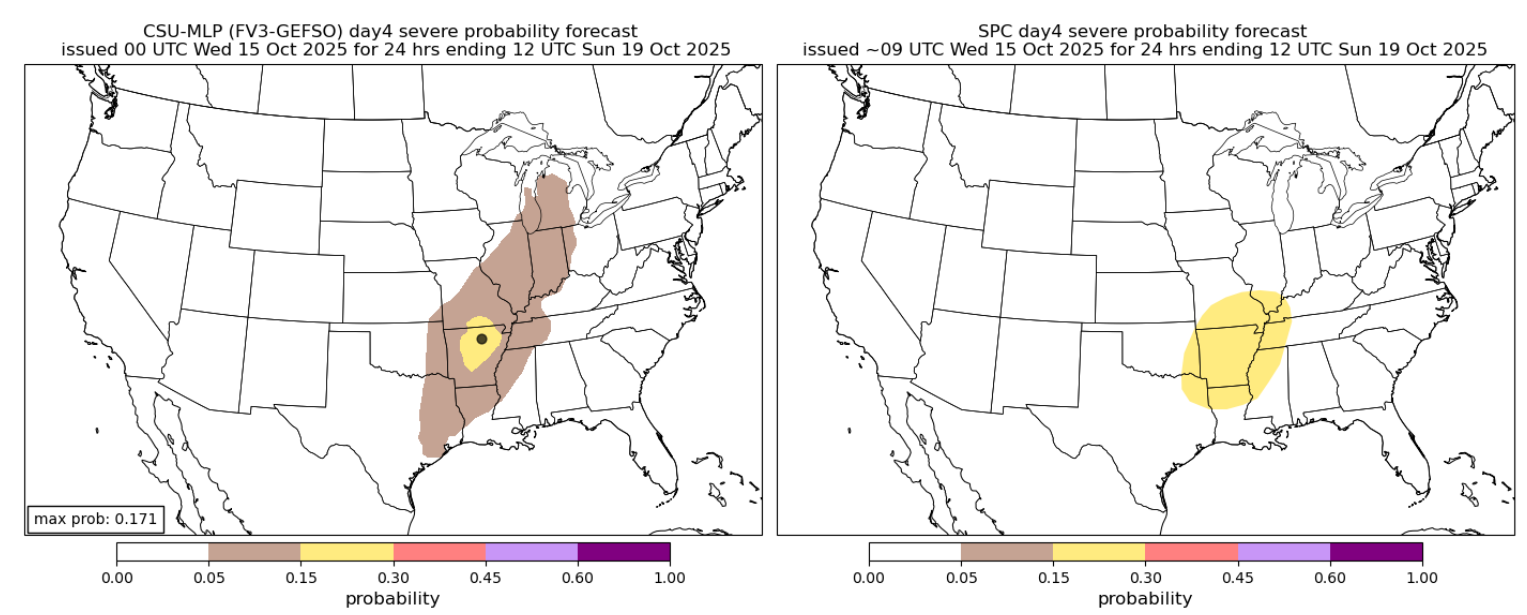
The GFS and Euro both think there will be just a lil’ bit of CAPE right along with line of showers and storms. There will be a little bit of shear along with this, which could lead to some gusty winds. Right now, there is no concern about tornadoes. This is something that we will be watching, but currently just not worried about it.
Timing is slowly being pushed back. Good news for your Saturday dinner/evening plans, but this isn’t set in stone just yet.
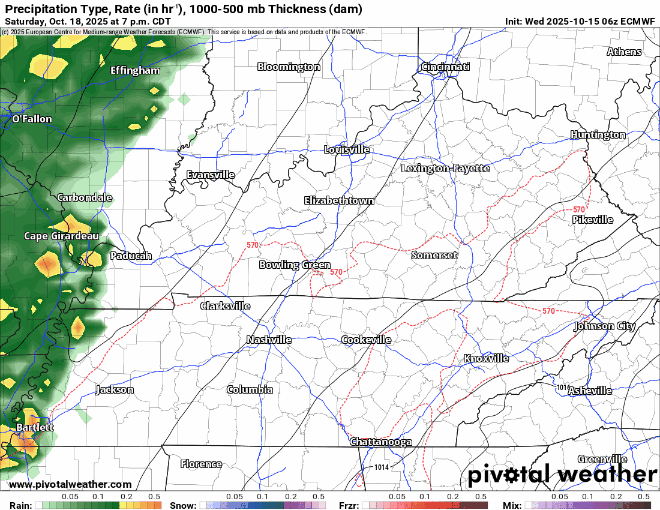
I’ll let the Euro model give a rough guess on what the radar could look like, but it won’t look exactly like this.
This particular run thinks rain/storms hold off until after midnight, arriving in the wee hours of Sunday morning, with on and off showers continuing thru Sunday afternoon.
The GFS thinks pretty similarly but shows rain clearing out quicker on Sunday (good news for Titans game).
Rainfall totals will be around 1″.
Timing will continue to get tweaked between now and then. Check back on timing and general thinking on things, especially if you have outdoor plans on Saturday.
Cooler temps after the cold front moves thru. At least the first couple days of next work week should be dry.
Categories: Featured Blog