
We continue our streak of cool mornings, warmer-than-average afternoons and dry weather throughout the work week.
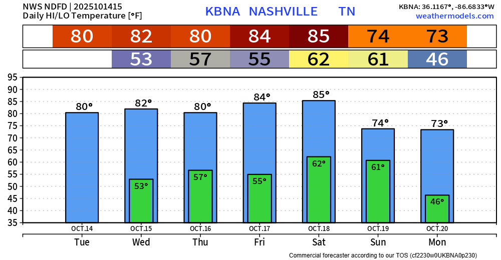
We get a pattern shift on Saturday/Sunday as a cold front will work thru the area, bringing showers/storms along with cooler temps following it.
The Euro model thinks the line of showers, maybe thunderstorms arrive early Sunday morning. GFS is a little earlier (per usual) with an arrival Saturday evening. Right now, I’d take a rough ETA of sometime between these, Saturday evening – Sunday morning.
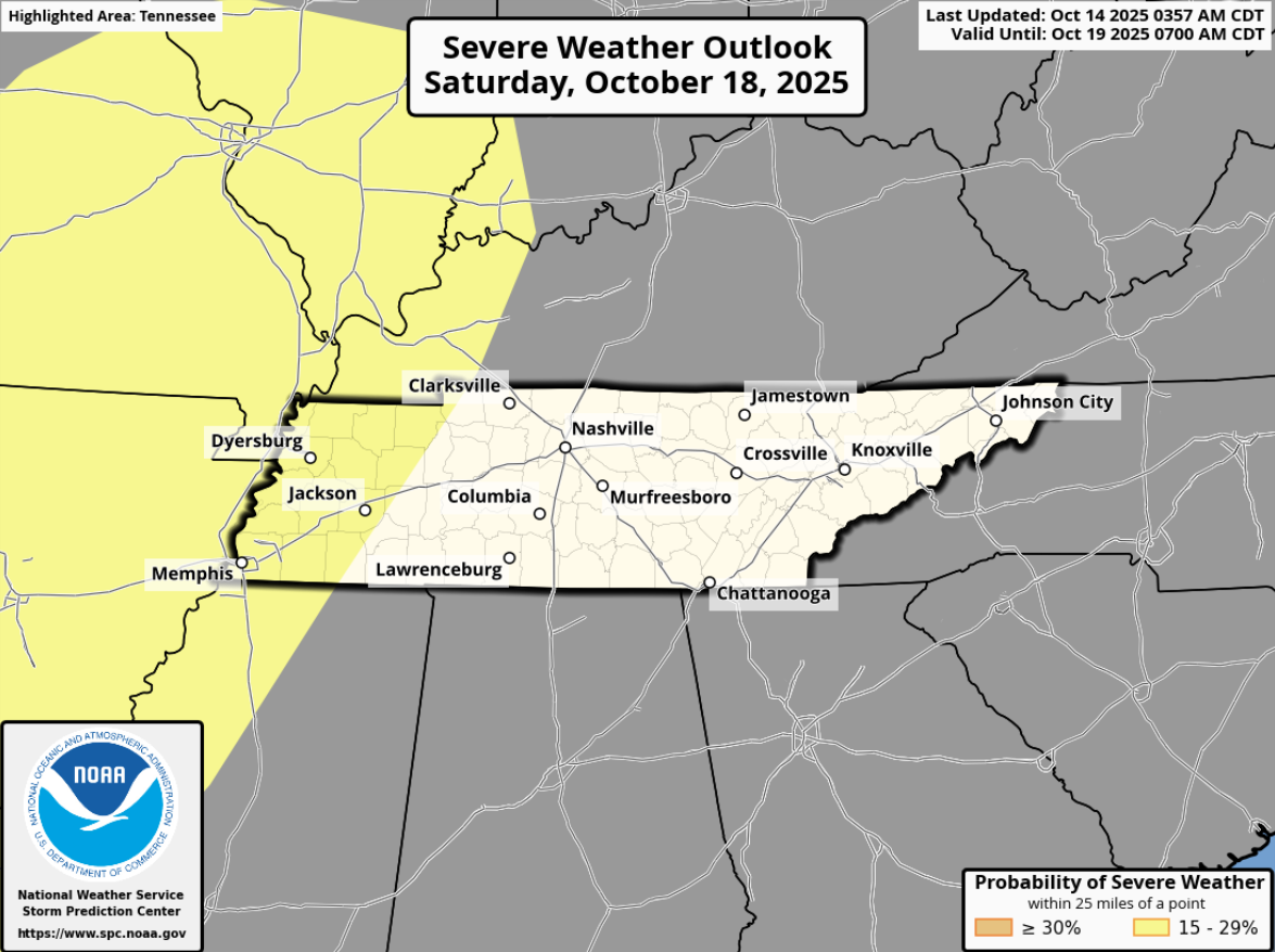
The Storm Prediction Center continues to exclude us from any severe probabilities as of right now, keeping them to our west.
Both the GFS and Euro ensembles agree with this thinking.
I don’t believe I’ve ever showed this model parameter before, but I think it’s a useful one. I’ll use the Euro ensemble, but the GFS thinks the same thing. Below is the probability that sufficient CAPE (storm fuel), sufficient shear, and rain will be exist at the same time at a given area. I probably didn’t explain that very well.
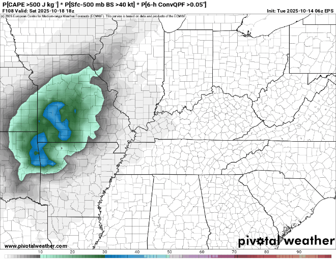
Anyway, low to medium probabilities of that are out to our west (in agreement with SPC), then drop off a cliff towards our area.
All that to say, there is currently not any severe weather expected from this. Could that change, sure, but it’s just not in the forecast right now.
Most of us will probably see some good rainfall from this, 1-1.5″ of rain.
General thinking right now is that we clear out by Sunday midday – afternoon. Tailgating and start of the Titans game may be wet.
Start of next work week looks like average temps and back to dry weather.
Categories: Featured Blog