
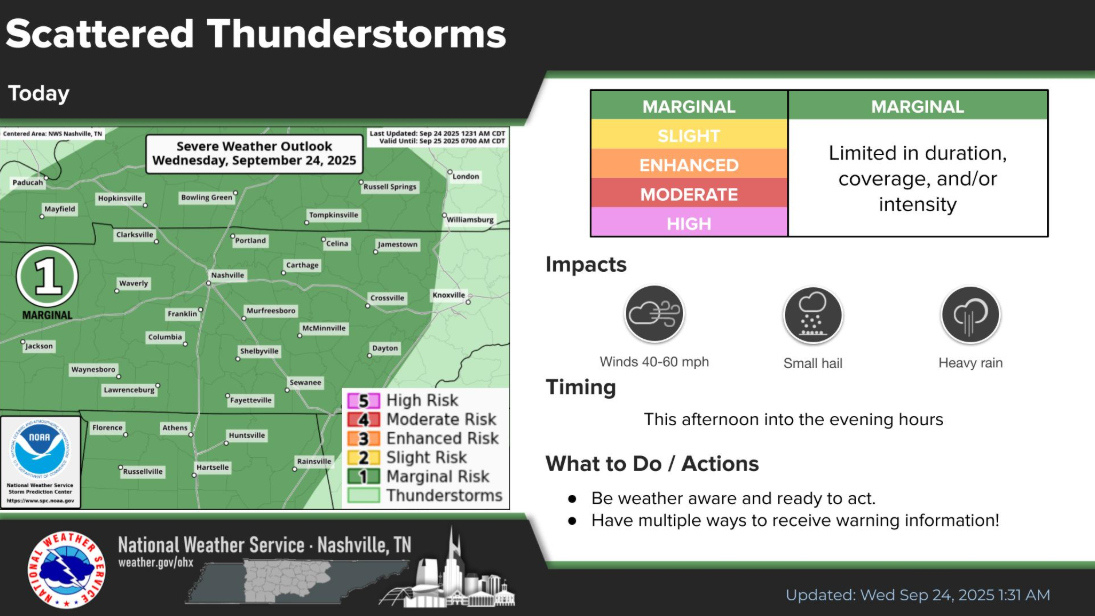
Today is the last day of our little stretch of low-end flash flood and damaging wind threat.
Timeframe for storms will be this afternoon into the overnight hours. Main focus will be on our threat for isolated flash flooding, then maybe some damaging straight-line winds (5% chance within 25 miles). Regardless, chances for both are low. We are not outlooked with any probabilities for tornadoes.
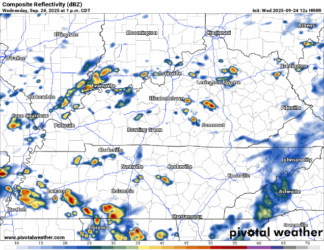
HRRR has been on the struggle bus the past few days trying to guess what’s going on. Am I still going to show its guess, yes. Please just don’t take it literally – just as a general idea.
We could see a few clusters of storms roll thru during this time. We’ll be watching for any training storms that could cause some flash flooding, along with any organized storm that could pose the risk of some gusty winds, maybe even some small hail.
As always, we’ll be posting real-time updates to all of our socials. In the low chance that we do see a Severe Thunderstorm Warning, we’ll go live on YouTube to track it.
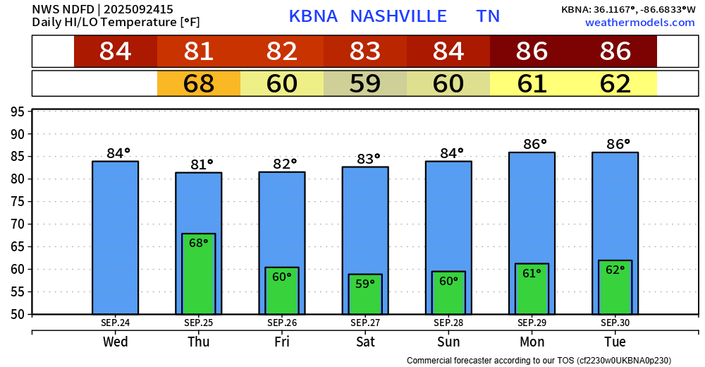
A few lingering showers, maybe a rumble of thunder, will be possible during the day on Thursday as the cold front finally pushes thru.
After the front moves thru, our rain chances will come to a close for the remainder of the week. No additional rain chances until maybe the beginning of next week. Although models think most of next week is dry – for now.
High temps around average thru this weekend until they creep up a bit by early next week. Long range models still not showing any real signs of legit Fall weather anytime soon.
Categories: Featured Blog