
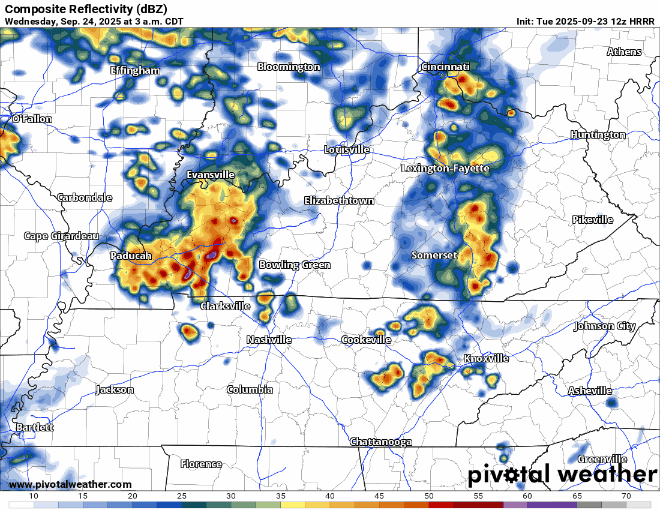
Activity from last night and this morning has moved out. Pretty much everyone got some healthy rainfall amounts, especially S of I-40.
Big question today will be if we see any additional storms this afternoon and evenings.
Some showers or storms certainly cannot be ruled out – and we’ll be watching the radar all day and posting updates on all of our socials. Can’t totally rule out a storm or two becoming strong, maybe briefly severe today as well. The potential for damaging straight-line winds will be the focus, but chances of those occurring are only 5% within 25 miles.
Additional showers and storms will be possible overnight tonight, into Wednesday AM. Similar to last night, some storms could be strong to severe with this as well – but gusty winds will be the concern.
Try not to take this HRRR run as gospel, just guidance on what the radar could look like:
This leads us into Wednesday afternoon and evening, when more question marks show up. More uncertainty exists about whether or not our environment will be able to destabilize following the morning showers/storms – if those even come around.
If we are able to see some destabilization, we’ll run the low-end chance for some severe weather – with damaging straight-line winds being the main threat. We are currently not included in any probabilities for hail or tornadoes.
This will be something we’ll be watching and will keep y’all updated on all of our socials as new info and data comes in.
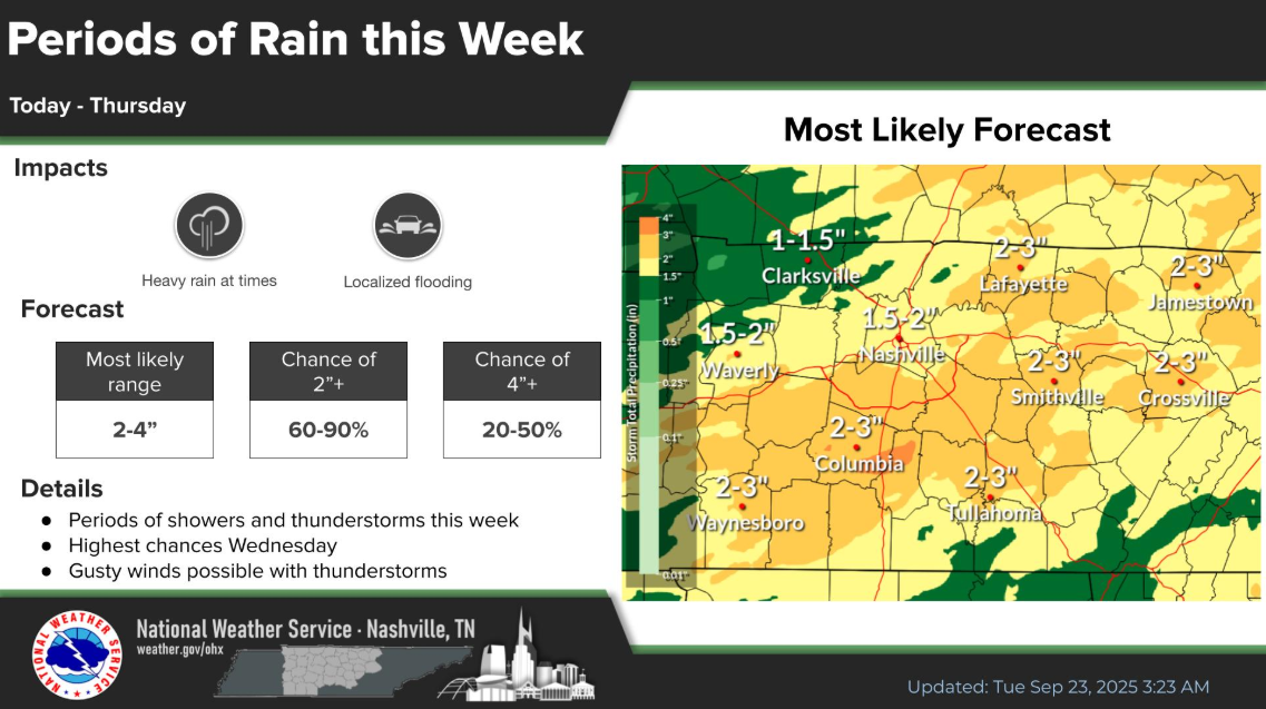
Regardless on the strength of storms, we’ll also be watching for the potential for a few instances of isolated flash flooding. Any storms that train over the same areas could quickly pick up a few inches of rain and could lead to some ponding on roadways/rises on creeks and streams. 1-3 inches of additional rain will be possible from today thru Wednesday night.
Rain should move out late Wednesday night, leaving with us with a dry rest of the week and weekend.
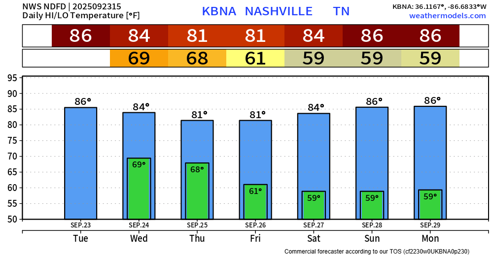
Temps remain around to slightly above average. Still no signs of true Fall weather.
Categories: Featured Blog