
Today, Tuesday, and Wednesday all carry a low-end threat for severe weather, with damaging straight-line winds and hail being the main threats. Not really concerned about tornadoes with this.
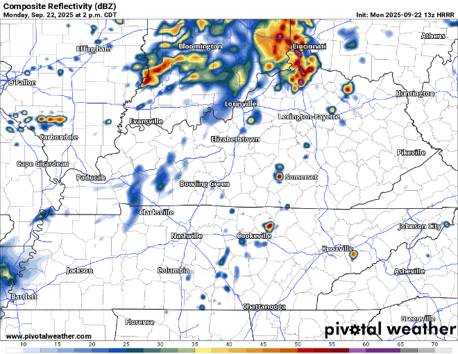
Monday:
Storm Prediction Center has us outlooked with a 5% chance of damaging straight-line winds within 25 miles today. We are not included in any hail or tornado probabilities.
You know not see rain today – but if you do see a storm, it could be strong to maybe severe. This can be applied to all days coming up.
The timeframe for storms will be afternoon thru late evening. Hard to get any more specific than that due to the scattered nature of the storms.
HRRR model, for what it’s worth – and it’s not worth a ton – shows most of the showers and storms off to our north. We’ll see about that.
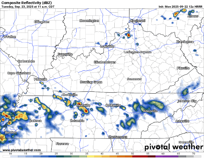
Tuesday:
HRRR model likes the idea of some early morning showers and storms – just in time for the AM commute, as if traffic isn’t already bad enough.
Don’t think there would really be a severe threat with these, but we could see some localized flooding if storms decide to train over the same areas.
SPC continues the theme with a 5% chance of damaging straight-line winds within 25 miles. Yet again, we are not included in any tornado or hail probabilities.
Maybe a break in the middle of the day, before more storm chances during the afternoon and evening.
HRRR model gives a guess:
Wednesday:
Our third and final day of being outlooked with yet again 5% chance of severe weather within 25 miles.
There’s some uncertainty with this (as always) – as some showers and storms will be possible in the morning. The question will be how much our atmosphere can destabilize before the afternoon. The GFS model thinks the rain pretty much sticks around all day, leading to a fairly stable environment. The Euro on the other hand thinks we are able to destabilize a good bit throughout the day.
Which model is right, who knows. Hopefully they’ll start to agree some more over the next day or so.
Rainfall:
We should get plenty of it over the next 3 or so days.
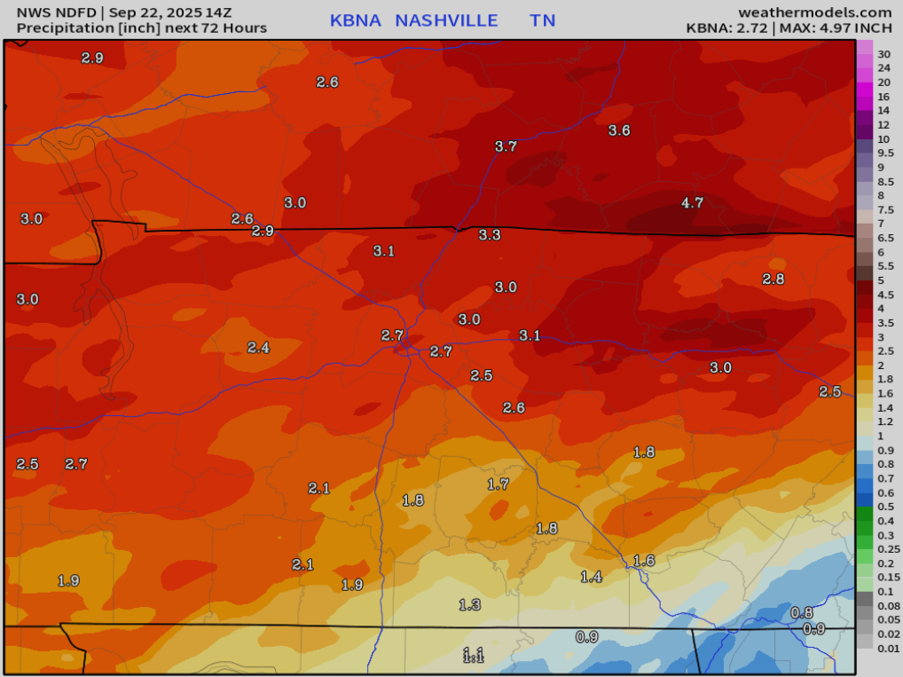
Nearly 3″ of rain expected over the next 72-ish hours. This should be spread out enough to where we avoid widespread flooding issues but can’t rule out some isolated flooding over the next couple of days.
Rain chances finally come down after Thursday and we should be rewarded with a dry weekend.
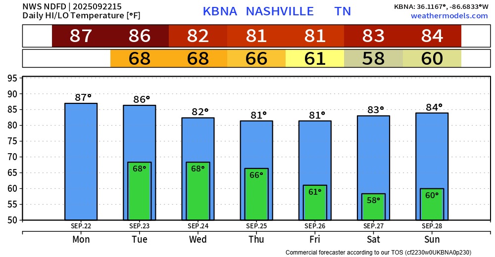
Average temperatures finally arrive by the middle of the week. Muggy dewpoints (mid to upper 60s) won’t feel great throughout the first half of the week.
Categories: Featured Blog