
Some showers and storms possible tonight, but activity should wind down as we get closer to sunset. Follow the socials for all the real-time updates.
High rain/storm chances will stick around Monday thru Thursday.
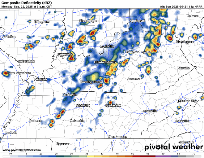
Starting with Monday, storms look possible during the afternoon and evening. There’s a low chance that a storm could briefly reach severe criteria, with gusty winds and small hail.
HRRR model gives it a shot below, timestamp in the upper left corner.
Tuesday is fairly similar to Monday – afternoon and evening showers and storms possible, low chances of a storm being strong to severe. Wattery (rain lottery) style, so no way of knowing exactly when and where.
“Rain chances are high Wednesday and Thursday with an increased potential for heavy rain and localized flooding” says NWS Nashville. Same ordeal these days as well, strong to maybe severe storms can’t totally be ruled out.
The Euro model likes our severe chances on Wednesday. This can (and probably will) change, but it’s something we’ll keep an eye on.
Rain chances taper off starting Friday, and we’ll only have low chances to deal with next weekend.
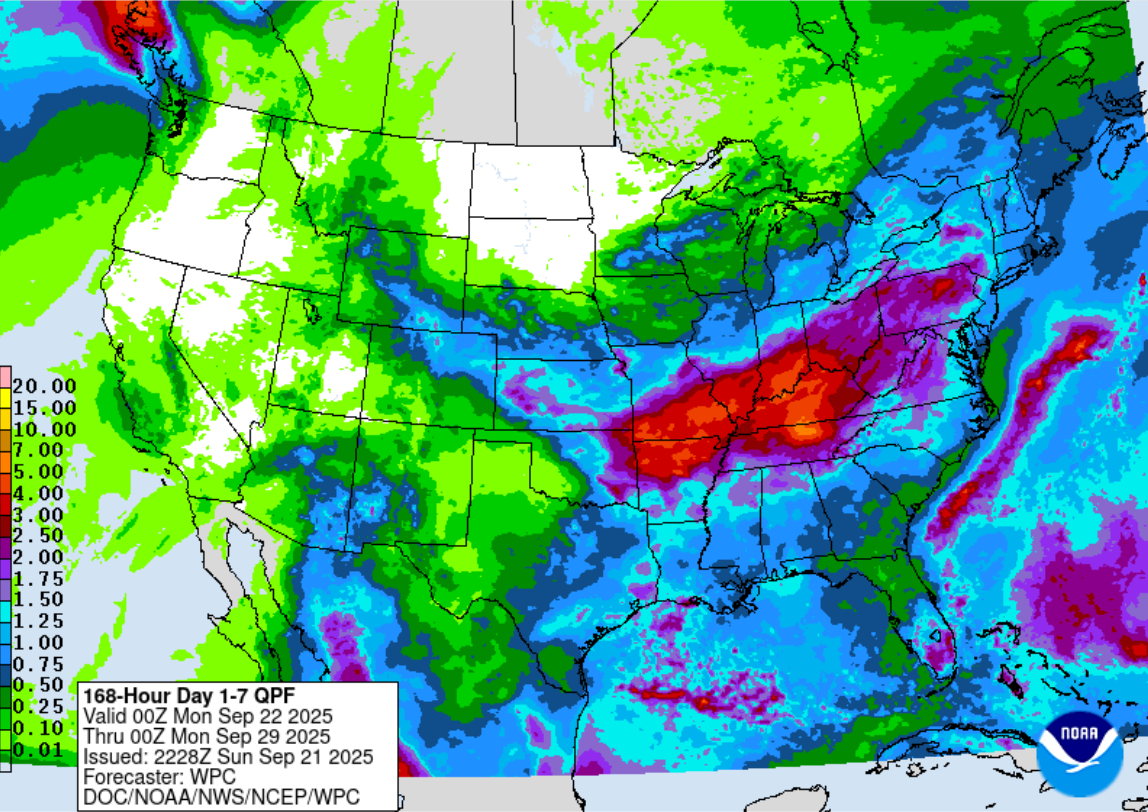
Healthy rainfall totals should be expected during this week – good news for grass. 2-3″ of rain over the next week. We’ll avoid widespread flooding issues, but we could see some isolated flooding under some heavy storms that train over the same areas.
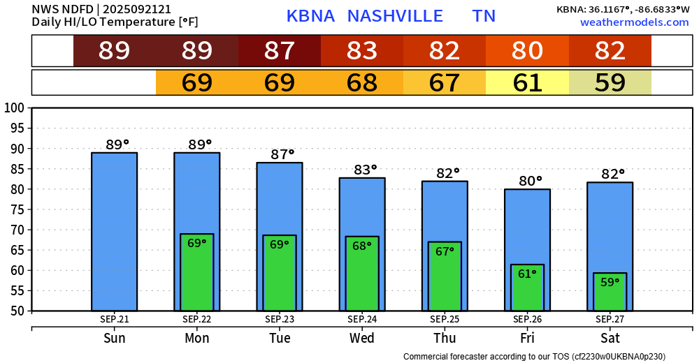
Temperatures chill out a bit throughout the week. Highs finally get closer to average for this time of the year by the middle of this week.
Categories: Featured Blog