
We have a very low-end chance for damaging straight-line winds today and Friday. It’s really not much, but let’s go day-by-day.
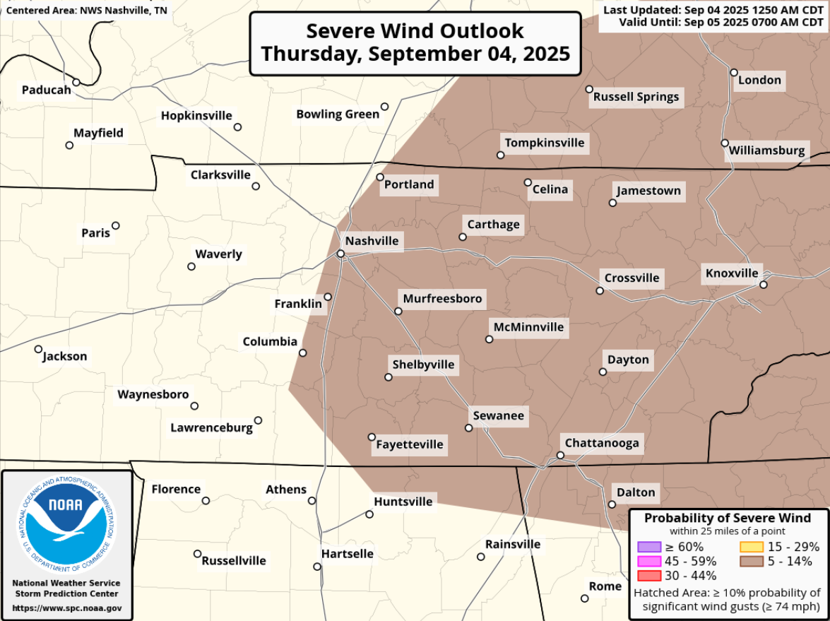
The Storm Prediction Center has outlooked most of our two counties with a 5% chance of damaging straight-line winds within 25 miles today. Tornadoes are not expected.
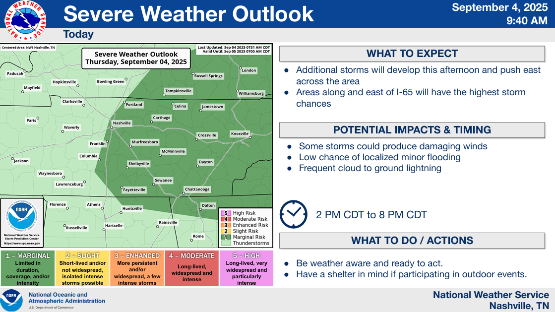
Although we saw yesterday, it doesn’t take being outlooked with any probabilities to see a decent storm.
A cold front will approach our area from the NW, and will spark off showers and storms along and ahead of the front.
The big question for us today will be if any activity is able to get going before the front passes us. The majority of high-res models continue to think that most of the storms won’t form until they are SE of us, leaving us dry.
We’ll see about that. If we do see anything, timing would be this afternoon and evening. We’ll be watching the radar all day and will post any updates to all of our socials.
We yet again outlooked on Friday, 15% chance of damaging straight-line winds and a 5% chance of severe hail within 25 miles. We are excluded from any tornado probabilities.
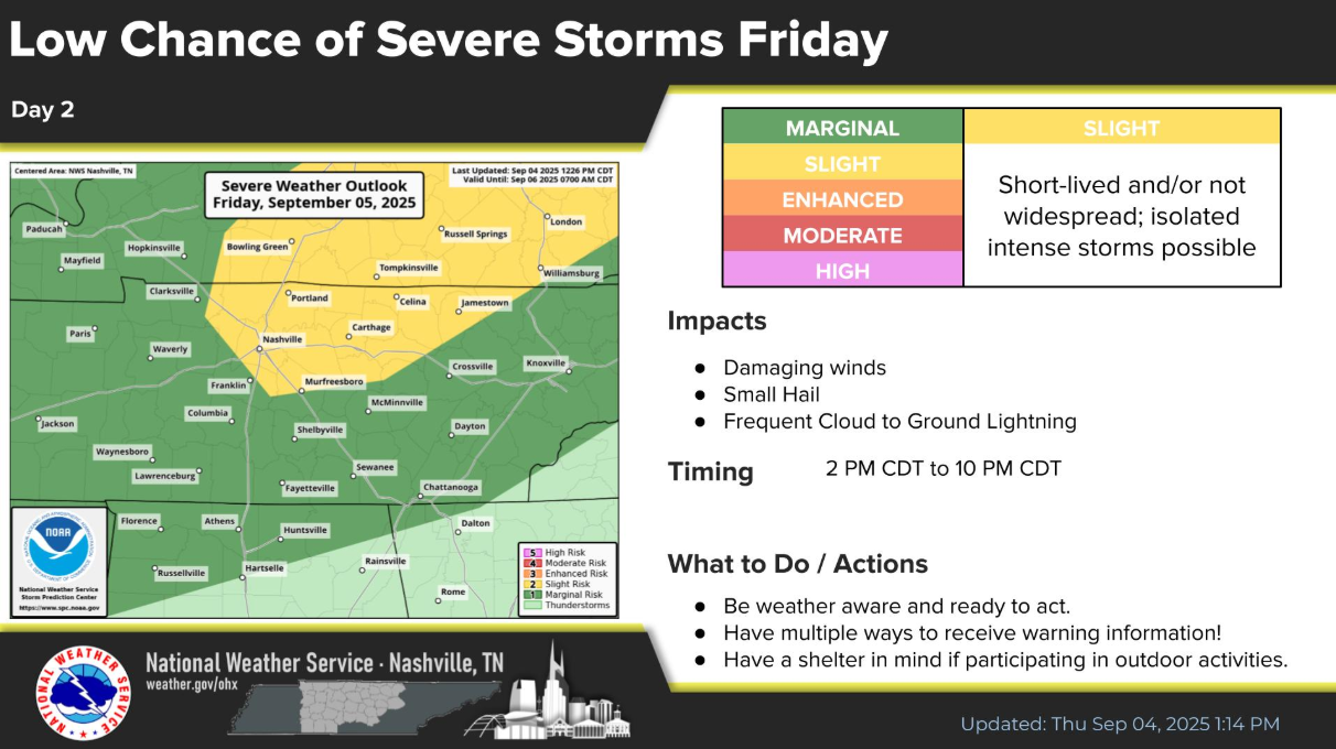
Timing looks to be Friday afternoon thru late in the evening for the very low-end potential.
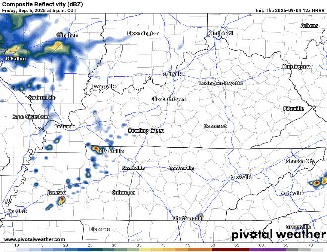
HRRR gives a guess on what the radar might look like, it thinks some of the storms hold off until a little later:
Those with PM outdoor plans should stay connected, you don’t want to get caught outside in one of these storms. Like today, we’ll be posting any updates to all of our socials.
Around 1″ of rainfall is expected thru Saturday, enough to avoid any flooding concerns, and also enough that your grass will appreciate it.
We could see some lingering rain on Saturday morning, maybe a rumble of thunder, but things should be clearing out by lunchtime – we’ll be left with a dry remainder of the weekend and start of next week.
Today and Friday will also be fairly warm, Friday you can just say hot. Highs Friday will climb into the mid 90s, heat index values near 100°.
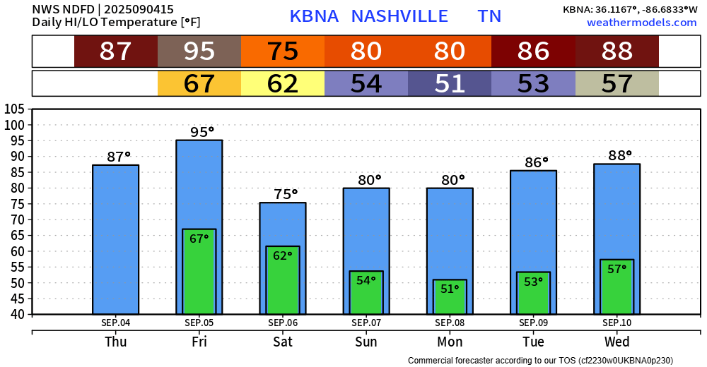
After we get thru these storm chances, we’ll have a very nice weekend ahead. Highs barely making it to 80°, much drier air filtering in as well – with dewpoints getting down into the 40s/50s.
Warmer temps come by the middle of next week, but it should still be tolerable as dewpoints stay in the 50s.
It’s Thursday, which means the updated Drought Monitor was released. It doesn’t show any good news.
Much of our two counties are now under a Moderate Drought.
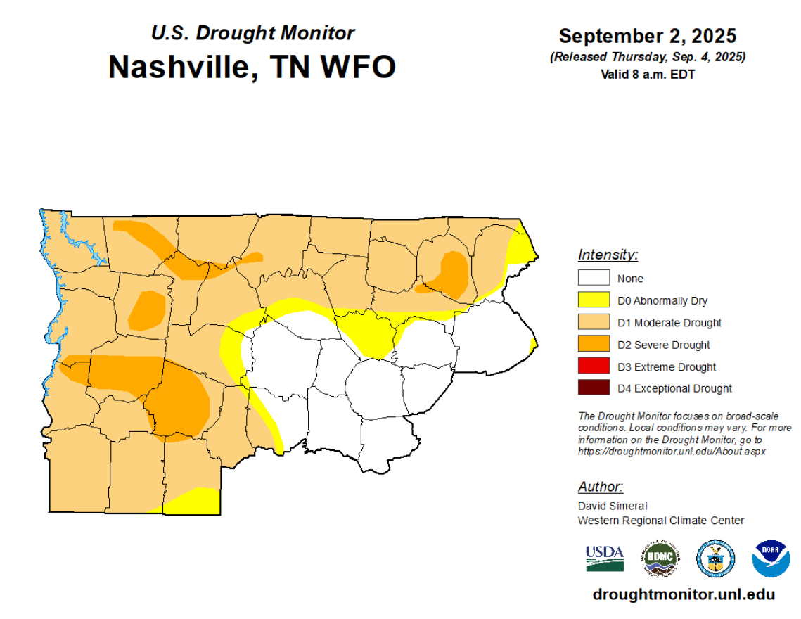
This doesn’t include any of the rain we got Wednesday evening. Hopefully we can pick up some decent rainfall totals over the next couple of days to try and put a dent in this.
Categories: Featured Blog