
Scattered showers and storms will remain in the forecast over the next several days – nothing too noteworthy though.
Looking at today [Tuesday], some showers have already affected southern WillCo., and more showers and storms will be possible throughout this evening.
HRRR gives a visual on what the radar could look like:
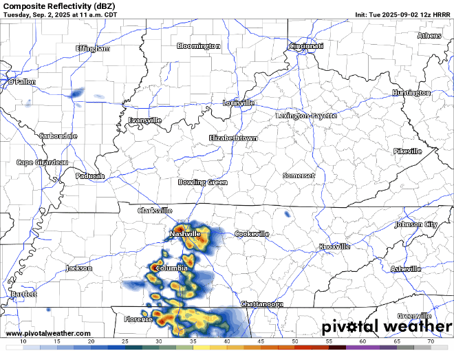
Not expecting any severe weather with any of this, but a few rumbles of thunders will be possible. The threat of isolated flooding will be very low but can’t totally rule it out with any storms training over the same area. We’ll be watching.
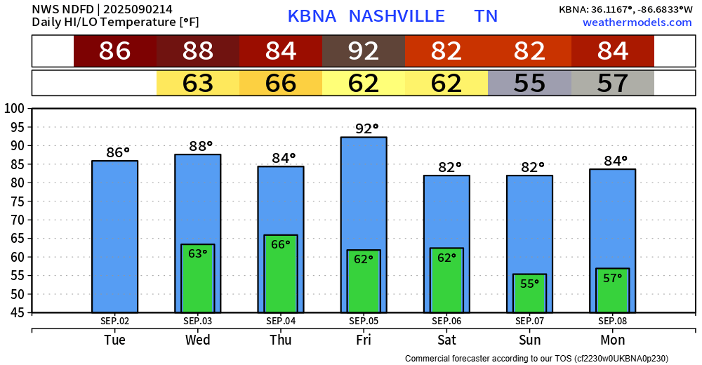
Low to medium rain/storm chances will hang around Wednesday and Thursday. Similar to today, no severe weather is expected, and any chance of isolated flooding will remain very low.
Very low rain chances will be around late Friday night thru early Saturday morning. Lots can change between now and then but not seeing this cause too many interruptions to any plans.

High temps stay relatively warm throughout the week, even peaking in the low 90s on Friday. Dewpoints will also be in the 60s throughout the work week, so that won’t help anything.
A cold front will swing thru Friday night, which is to blame for our low rain chances, but following the cold front – much nicer dewpoints in the 40s/50s will come in for the weekend.
Categories: Featured Blog