
Not too bad of a Labor Day forecast.
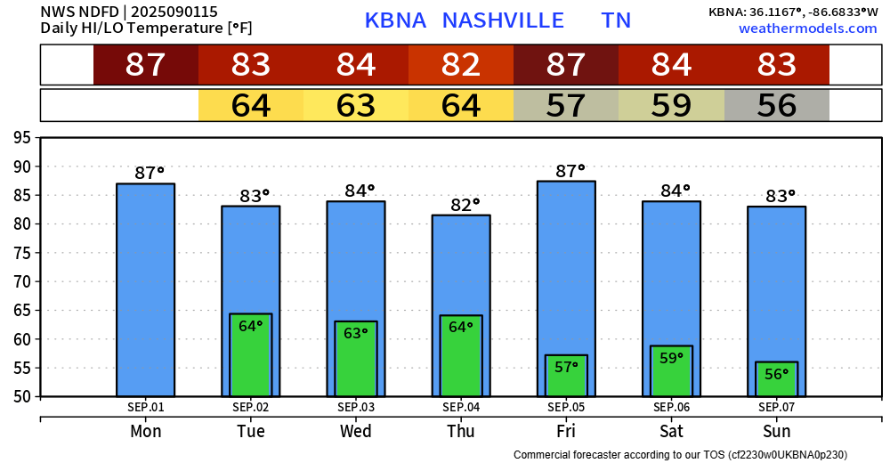
A bit warm and muggy, with high temps in the upper 80s, dewpoints in the low 60s – it could always be worse.
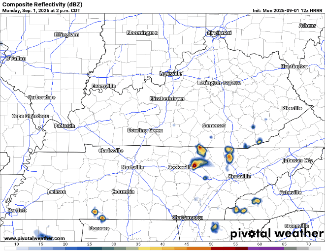
We could see a few showers and storms around the area this afternoon and evening. Wattery (rain lottery) style, so impossible to know exactly when and where these might pop up.
Thankfully, no severe weather is expected – but we could see a few thunderstorms. Those with outdoor plans, maybe spending the day at the lake or pool, should keep an eye on the radar. When thunder roars, go indoors.
Here the HRRR model’s educated guess on what the radar could look like this PM:
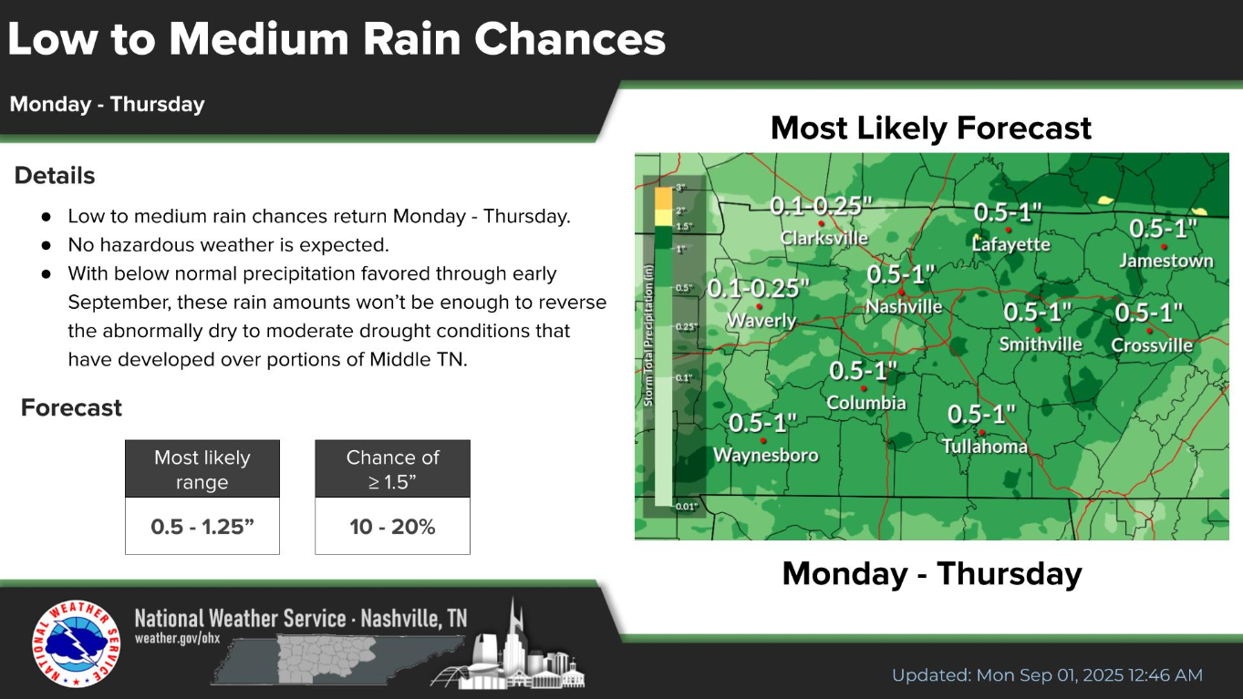
More of the same is expected on Tuesday, Wednesday, and Thursday – with slightly higher rain chances at 40-60%.
Chances look highest Tuesday afternoon thru early Wednesday morning, and then again Thursday afternoon.
Still not expecting any severe weather, but again there could be enough instability (storm fuel) for a few thunderstorms. Rainfall totals from Monday – Thursday generally in the 0.5 – 1″ range – not expecting any flooding issues.
Temps stay relatively warm throughout the week in the 80s – nothing crazy though. Dewpoints will be in the 60s thru Thursday, so it’ll feel fairly muggy.
Drier air comes in Friday and stays for the weekend, dropping dewpoints down into the 50s – much better.
Categories: Featured Blog