
Today was hot. BNA reached 101° today, the first time we’ve hit triple digits since last August.

It’ll still be hot over the next several days, but thankfully not that hot.
High temps will “only” be in the low 90s thru this weekend. More manageable.
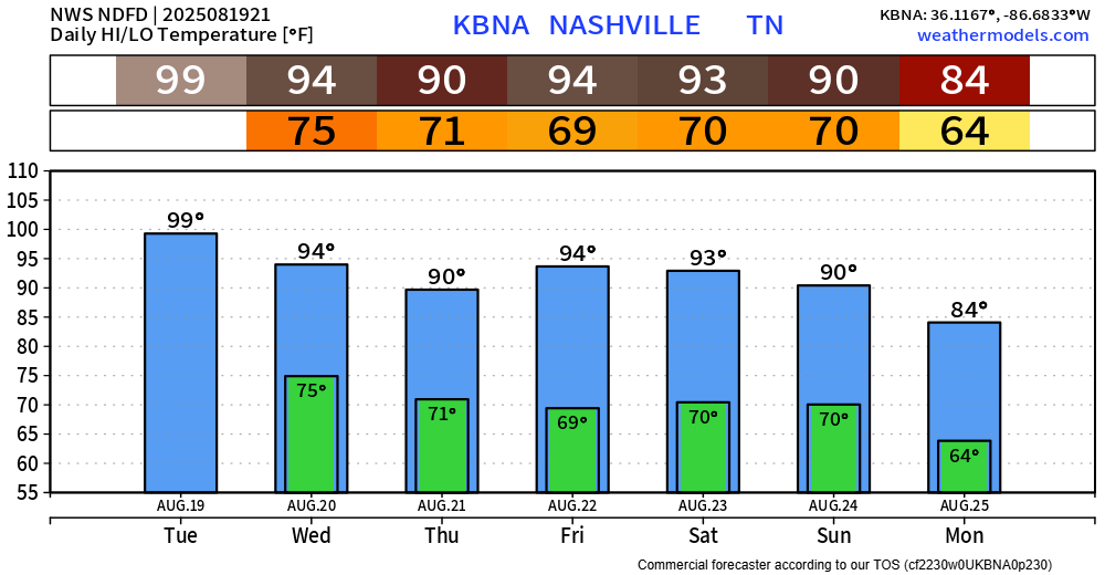
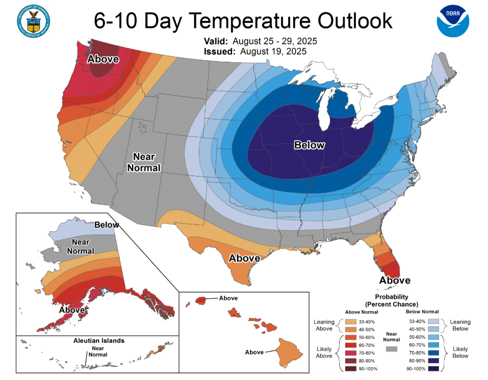
The beginning of next week looks even better. High temps dip below average and are likely to continue to do so in the 6 – 10 day range. Sign. Me. Up.
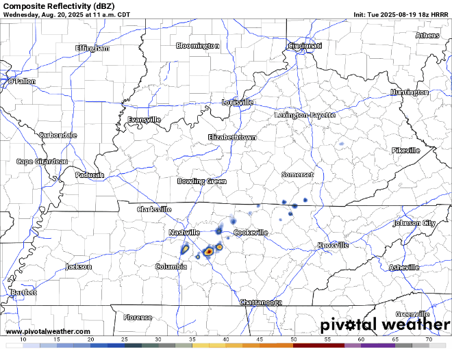
Rain/storm chances will be around ~50% on Wednesday. Mostly during the afternoon and evening hours.
HRRR model (shown below) thinks most of the activity stays to our SE, we’ll see about that.
After Wednesday, our rain chances drop down a good bit. Really think the rest of the week is mostly dry but can’t totally rule out a quick shower or storm one afternoon or evening.
Categories: Featured Blog