
You’ve probably noticed, but it’s hot outside.
Temperatures are in the upper 90s right now, and dewpoints near 70° are pushing our heat index values towards the 105-108° range.
That is the reason we have a Heat Advisory until 7p Tuesday.
Please take it easy if you must be outdoors for long periods of time. Heat illness can set in quickly under these conditions. Stay hydrated, take breaks, and know the signs of heat illness.
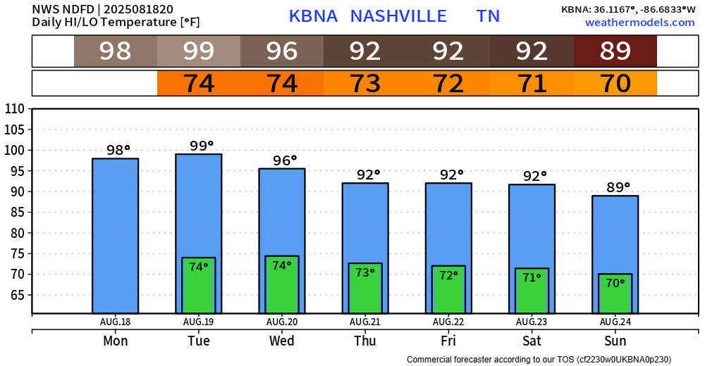
The good news is this heat won’t last forever. Temperatures relax towards the end of the week back to average for this time of year. It’s still hot, bc August, but not as hot.
We stay dry today (Monday). Low chances for a shower or storm on Tuesday before medium chances arrive on Wednesday.
This is all Wattery style, summertime pop ups, mostly confined to the afternoon and evening. No severe weather expected, but any storm could contain heavy rain, lightning, and gusty winds.
Our atmosphere will be pretty water loaded, so will have to watch for any ponding on roadways with any slow-moving storms dumping rain.
Low Wattery chances continue thru at least the weekend, but more dry than wet.
Categories: Featured Blog