
The heat will be the main story over the next several days.

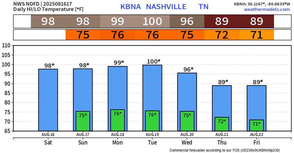
High temperatures will be in the upper 90s, maybe hitting 100° each day thru Tuesday.
Dewpoints will be a muggy ~70° during this time, causing heat index values to get up near 105° each day.
NWS Nashville says that we’ll likely need a Heat Advisory for Monday and Tuesday – as this seems to be the peak of the heat, when heat index values up to 109° will be possible. Actual air temps may reach 100° – something we haven’t done since last August.
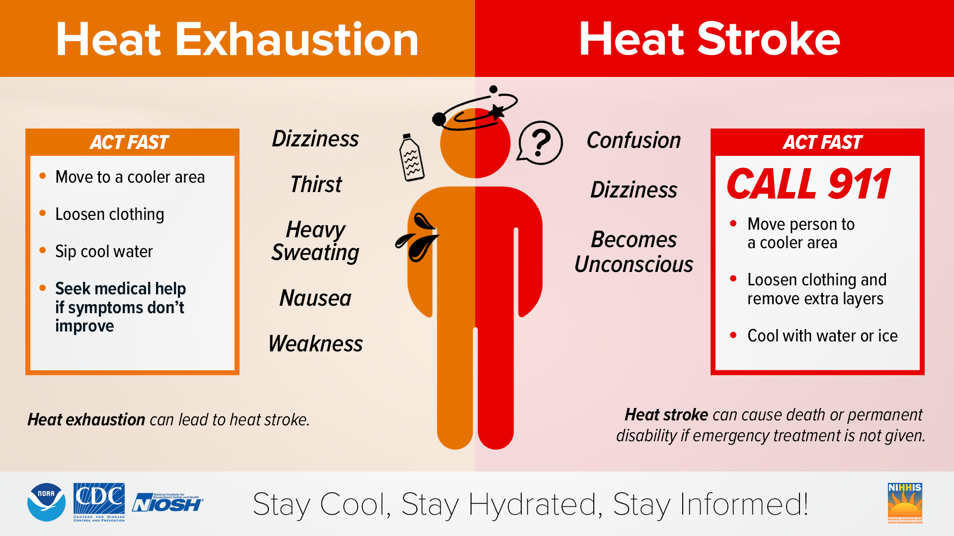
Those with outdoor plans this weekend and early next week need to exercise caution. Take frequent breaks, stay hydrated, wear light-colored and loose-fitting clothing. This kind of heat can quickly lead to heat illness. Know the signs and watch out for others who may be experiencing symptoms.
Most of us will have a dry weekend. Rain chances are very low, but not zero. Can’t totally rule out a stray afternoon/evening shower or storm thru Tuesday.
Our chances increase on Wednesday and continue thru late next week, along with temperatures dropping back towards average for this time of the year (upper 80s) – hooray. But for now, we bake.
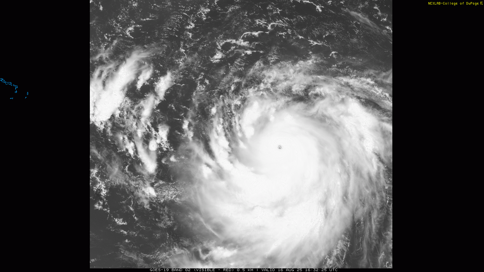
Totally unrelated to our local weather, but you may have heard of Hurricane Erin. As of 1p on Saturday, Erin is a powerful 160mph Category 5. Thankfully, models are all in great agreement that Erin will stay far away from the US. Eye candy on satellite tho. For the latest on all things tropical, see the National Hurricane Center here: National Hurricane Center
Categories: Featured Blog