
Isolated showers and storms will continue thru the evening, but isolated is the key word here. Most of us will stay dry, while a few folks might see a thunderstorm – your grass would love it, I’m sure.
Saturday thru Monday all look dry – no meaningful rain chances.
Low rain/storm chances return Tuesday and stick around thru at least the middle of next week.
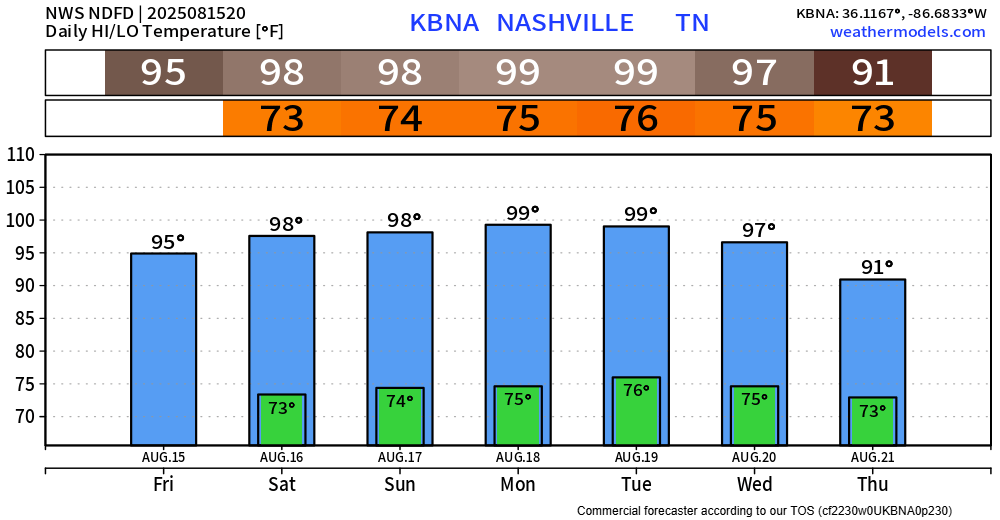
Our trade-off for a dry weekend will be the return of some very hot temperatures.

High temps in the upper 90s will be with us Saturday thru Wednesday. There may be a day or two in there when we do hit the 100° mark – which would be the first time since last August.
Dewpoints will be around 70°, making it feel just gross out.
Heat index values (“feels like temps”) will peak near 105°. We may see a Heat Advisory or two, but too far to know for sure right now.
Regardless, those with outdoor plans should plan accordingly. Take frequent breaks, stay hydrated, and watch out for signs of heat illness.
Good news is temps should relax a bit late next week.
Categories: Featured Blog