
All was quiet today on the radar, but this will likely change over the next couple of days.
Rain/storm chances will be ~60% during the afternoon and evening hours of Tuesday and Wednesday.
Still far away from any guarantees, but chances will be much greater than what we’ve seen the past several days. Thankfully, we still don’t have any severe worries – but a few storms could be on the stronger side with heavy rain, frequent lightning and gusty winds.
Going to hold off on showing any high-res models, such as the HRRR just due to the showers and storms being ‘Wattery’ style – random, pop-up at any point during the PM hours, sort of deal. The stuff we are used to seeing during the summer.
Our chances decrease to the 20-40% range starting Thursday thru the rest of this week. Same sort of deal, Wattery style, no severe worries.
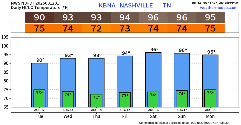
High temps will be in the low 90s for the next couple of days before increasing to the mid 90s by late this week, into early next week.
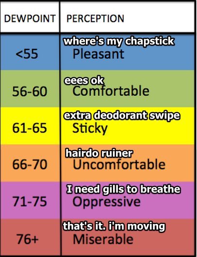
The increase in moisture (and rain chances) will be felt, as dewpoints will be closer to 70° this week. Frizzy hair will be common this week. These dewps will cause heat index values to get up near 100° during the afternoon(s). Those that must be outdoors for long periods of time should continue to take precautions against heat illness.
Categories: Featured Blog