
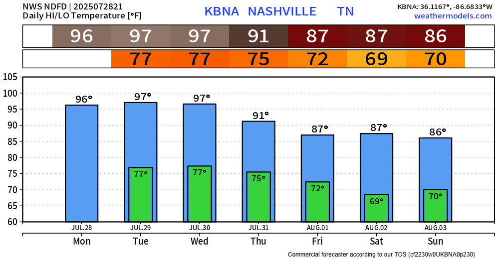
Today was our 27th consecutive day of 90°+. Tied for the 6th longest such streak on record.
We are likely to see 28, 29, and possibly 30 [consecutive days] by Thursday. For those curious, the record is 34 consecutive days, set in 2007 per NWS Nashville – thankfully we won’t see that.

Tuesday and Wednesday will be just as hot as today, if not hotter.
Heat index values will continue to be in the 105-110°+ range.
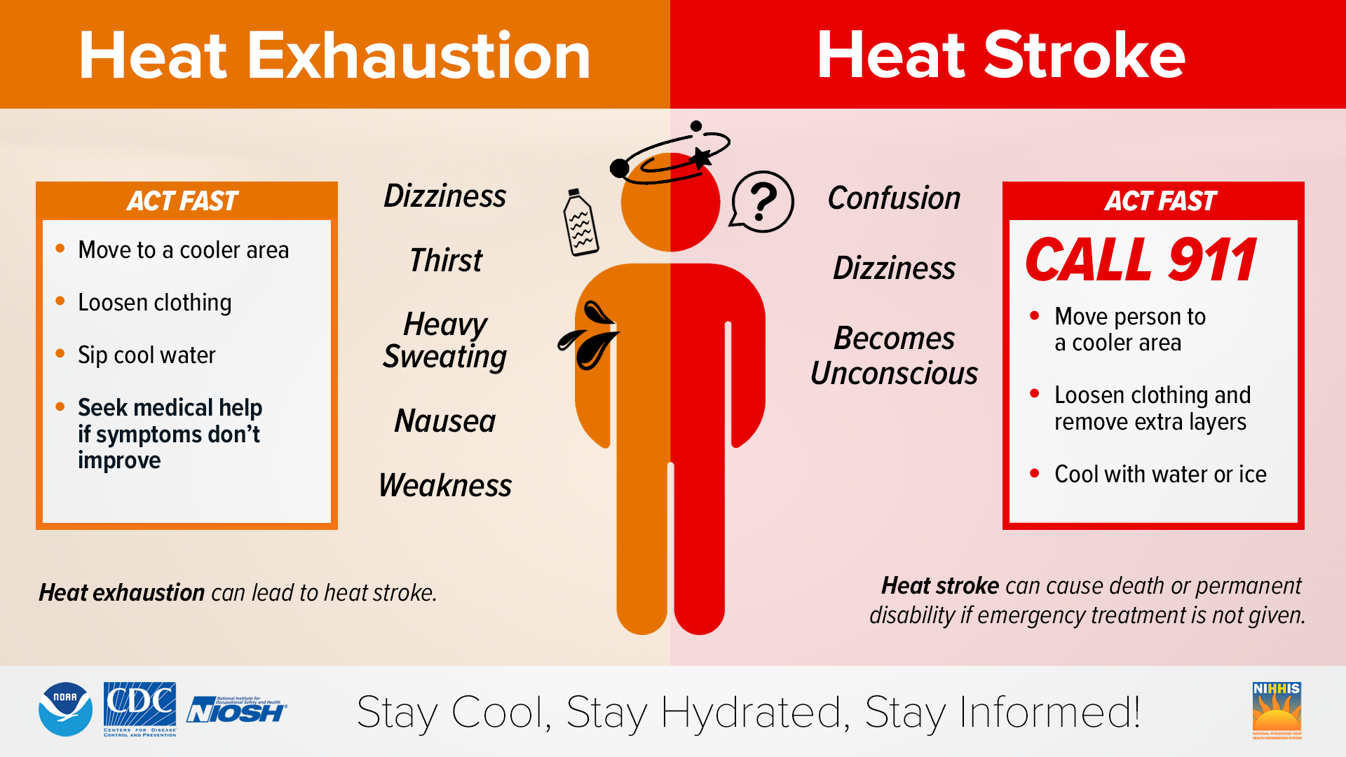
Please continue to take precautions if you must be outdoors for long periods of time. This combo of heat + humidity will stress your body after just 15 minutes of being outside. Stay hydrated and take frequent breaks. Never leave a child or pet in a locked car.
While it will not be “cool” – temps will relax a bit as we start the new month.
HRRR likes our chances of a shower or storm this evening, but current observations are in disagreement with it. We’ll be watching.
Our low chances of a shower or storm continue on Tuesday – mostly likely in the afternoon and evening.
Our chances get bumped up towards ~50-75% from Wednesday thru Friday – still mostly likely in the afternoon and evening.
Still not outlooked for any severe potential from the Storm Prediction Center, but as you’ve read many, many times by now – any storm could contain heavy rain, frequent lightning and gusty winds.
Rain/storm chances relax a bit by this weekend.
Categories: Featured Blog