
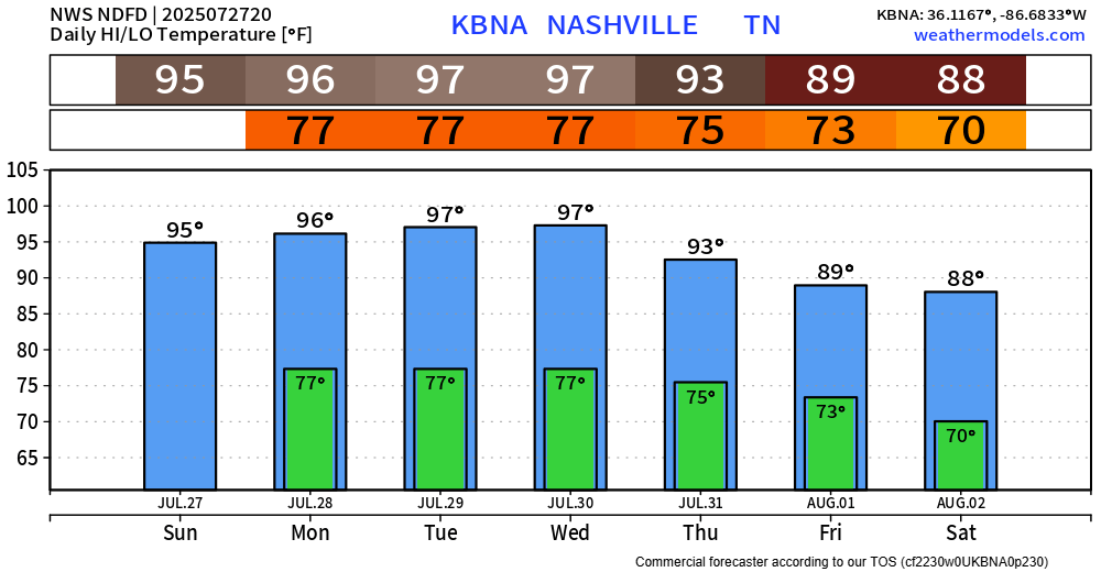
Our Heat Advisory started this morning and will continue thru 8p Wednesday.
Heat index values will peak in the 105-110° range each afternoon and evening.
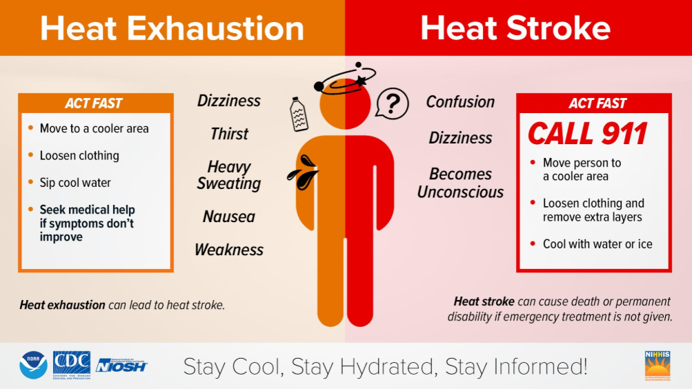
For those that must be outdoors for long periods of time, please take it easy. Take frequent breaks, stay hydrated, and watch out for signs of heat illness.
The heat will be at its worst Monday thru Wednesday. NWS Nashville is still watching for the potential for heat index values to creep up into the 110 – 115° range – in which case, an Extreme Heat Warning may be needed. Although this doesn’t seem like the most likely scenario, it’s not totally out of the question. Regardless, it’s going to be very hot and you should take precautions against the heat.
Our streak of 90°+ will likely come to an end early August, when we finally see temperatures slip back down to around average for this time of year. By no means will it be “cool” – but certainly an improvement.
Earlier runs of the HRRR model thought our chances looked halfway decent at seeing a shower or storm to cool us off this afternoon and evening – but latest runs have backed off on this and now think majority of us see a dry rest of the day. This makes sense based on current observations, but a few folks seeing a quick shower or storm remains a possibility.
Our rain/storm chances will remain on the low side for Monday and Tuesday before creeping up into the medium to high range for Wednesday thru Friday. Any day, chances will be highest during the afternoon and evening. Thankfully, no severe weather worries. However (you’ve heard this plenty), any storm could contain heavy rain, lightning and gusty winds.
Categories: Featured Blog