
Our Heat Advisory has continued to get extended and is now valid until 8p Thursday.
Heat index values will continue to peak near 108° each afternoon and evening.
And it looks like this brutal temp + dewpoint combo will be a common theme for us thru the end of July.
High temps will dip just a few degrees this weekend before they climb back up into the upper 90s by the beginning of next week.
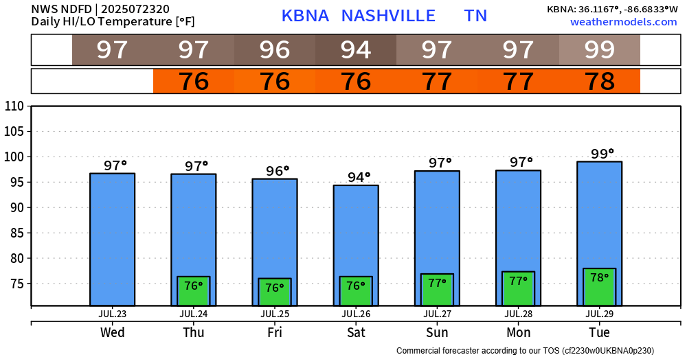
We’re still pretty far from any records, but regardless – it’s still hot.
Please take frequent breaks if you must be outdoors for long periods of time, stay hydrated and check in on friends and family.
Wattery chances look relatively low over the next 5 or so days. Looks likely the majority of us stay dry thru end of the work week. Chances increase a tad by this weekend, but they remain fairly low at ~20-25%.
While it’s more likely you stay dry, any storm that does popup can still contain heavy rain, frequent lightning and gusty winds. If you have outdoor plans, along with staying cool, stay weather aware and keep an eye on the radar.
Categories: Featured Blog