
Several showers and storms are out there tonight, being sparked off by outflow boundaries. If you have outdoor plans, keep an eye on the radar – when thunder roars, go indoors. No severe worries, but heavy rain (w/ isolated flooding), frequent lightning and gusty winds all possible. Some will stay totally dry.
Our daily rain & storm chances continue, peaking on Saturday – although low to medium chances will exist thru next week. Thankfully, coverage looks to be more isolated as we head towards the middle of next week.
Our main focus will be on the potential for isolated flooding with any slow-moving storms. If you encounter a flooded roadway – turn around, don’t drown.
The main story for the upcoming forecast will be the heat.
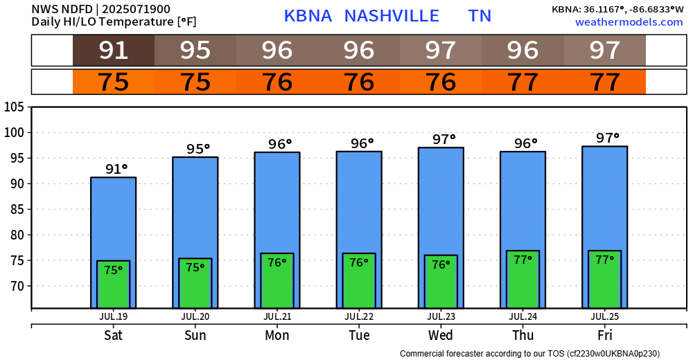
High temps will stay in the mid to upper 90s (besides Saturday, thanks to higher rain chances). Those temps, paired with dewpoints in the mid 70s will lead to heat index values around 105°. I won’t be surprised if we saw a couple of Heat Advisories in the coming days.
If you must be outdoors for long periods of time, please take frequent breaks, stay hydrated, and don’t push it. Heat illness can set in quickly with such conditions.
Categories: Featured Blog