
Although we have missed out on any showers or storms so far today, the HRRR model has been consistent with the thinking that somewhere in Middle TN will see some storms closer to sunset. Something to keep an eye on if you have any outdoor plans this evening. You can check the radar on our website anytime right here: Radar | Nashville Severe Weather
Any blog from the past week is going to sound fairly similar, and this one isn’t much different.

Our gross temperature + dewpoint combo isn’t going anywhere, anytime soon.
High temps Friday and Saturday will “only” be in the low 90s, so while still a scorcher (especially with dewps in the mid 70s) – we’ll remain below Heat Advisory criteria, but heat index values will remain close to 100°.
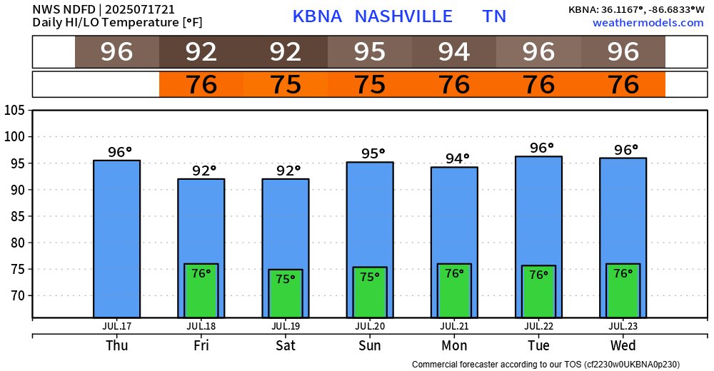
High temps return back to the mid 90s by early next week, when I wouldn’t be shocked if we saw another Heat Advisory or two.
Please take it easy outdoors, take frequent breaks, stay hydrated, and check in on your neighbors. Never, ever leave a child or a pet in a locked car.
We continue to have our daily medium chance for a shower or storm, mostly confined to the afternoon and evenings. It’s all Wattery style, so no way of knowing exactly when and where.
Our main focus will be on the potential for isolated flooding with any slow-moving storms. Our atmosphere is water loaded (this morning’s balloon showed our PW at 1.9″ for u nerds) and “could support rain rates up to 3 inches/hour” says NWS Nashville. If you encounter a flooded roadway, turn around – don’t drown.
And of course, any storm could contain frequent lightning and gusty winds. If you have outdoor plans, please stay weather aware and head indoors when thunder roars.
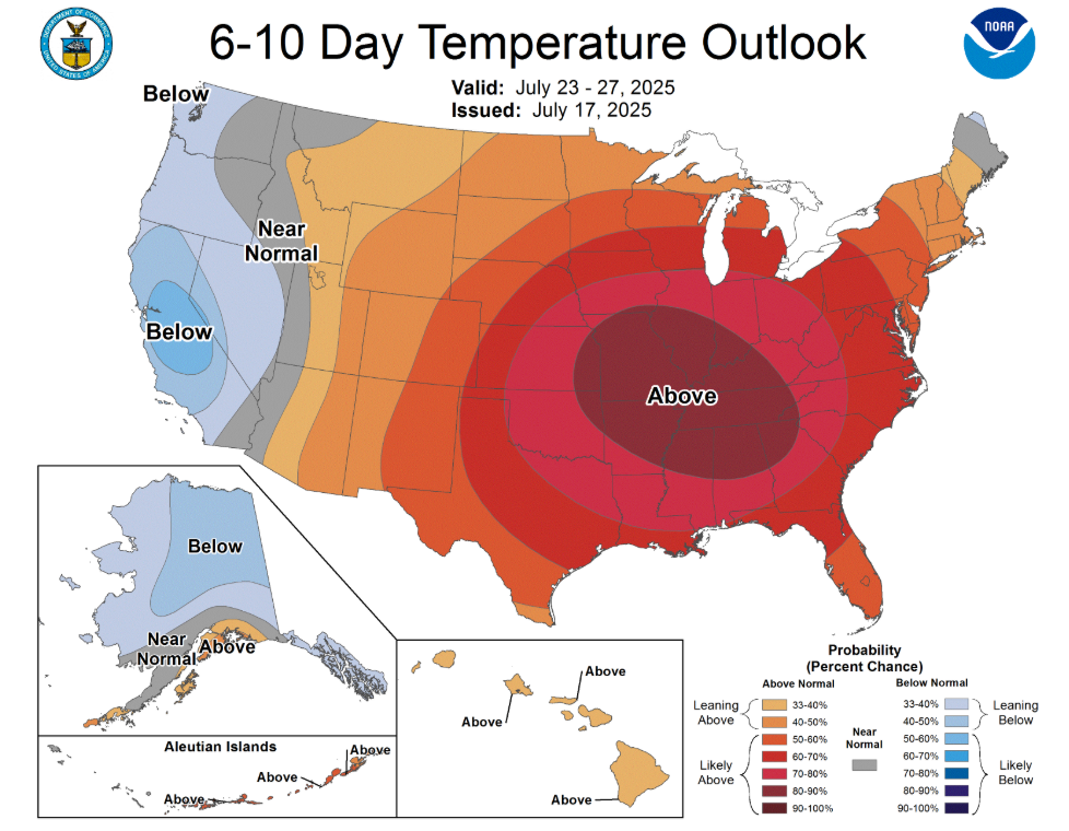
Our new 6-10 day temp outlook brings bad news.
Categories: Featured Blog