
The main highlight of the upcoming forecast will be the heat.
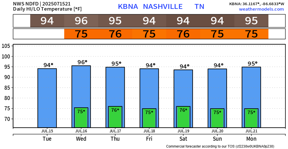
The graphic below from NWS Nashville is valid for Wednesday but can really be applied to most days this week.
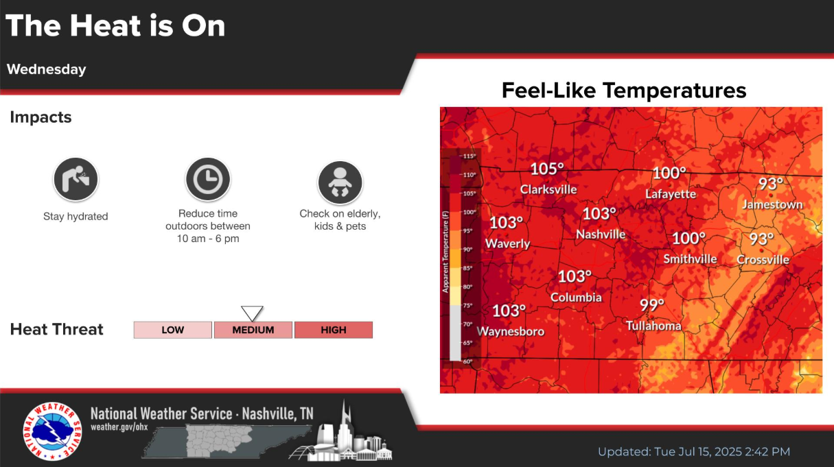
Our high temps will stay fairly consist in the mid 90s, while our dewpoints creep up into the mid 70s. This is a gross combo and will send our heat index values (“feels like”) near 105°. This is right around the criteria for a Heat Advisory, so while none are currently out for us – I wouldn’t be shocked if we saw one a day or two.
This combo will stay fairly consistent thru at least this weekend. Please, take it easy outdoors, stay hydrated, and take frequent breaks.
Each day thru at least early next week will continue to have a low to medium chance for a shower or storm. Chances are relatively higher towards the end of this week compared to Wednesday and Thursday – but nevertheless, it’s possible any day.
Wattery style continues, so impossible to know exactly when and where a shower or storm may form. No organized severe weather, but any storm can contain heavy rain, frequent lightning and gusty winds. Isolated flooding continues to be a possibility with any slow-moving storms, thanks to our high levels of Precipitable Water and weak steering aloft.
For those with outdoor plans, keep an eye on the radar – when thunder roars, go indoors. We’ll be watching and posting anything noteworthy to our socials.
Categories: Featured Blog