
Last week’s weather continues on into the new week.
Low to medium chances for showers & storms continue daily, with chances being highest from midday thru early evening.
Some days you may see no rain, others you may see a little too much rain – like those near Hermitage today. Isolated flooding continues to be our main threat, along with frequent lightning and gusty winds. If you encounter a flooded roadway – turn around, don’t drown.
It’s all Wattery style, so impossible to know exactly when and where. If you have outdoor plans, don’t get caught off guard – stay weather aware and keep an eye on the radar.
We’ll be watching every day, and will provide updates on all of our socials as needed.
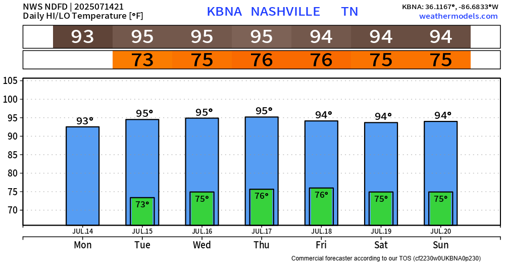
High temperatures continue to stay steadily above-average. Heat index values will peak in the low 100s if you manage to avoid any rain.
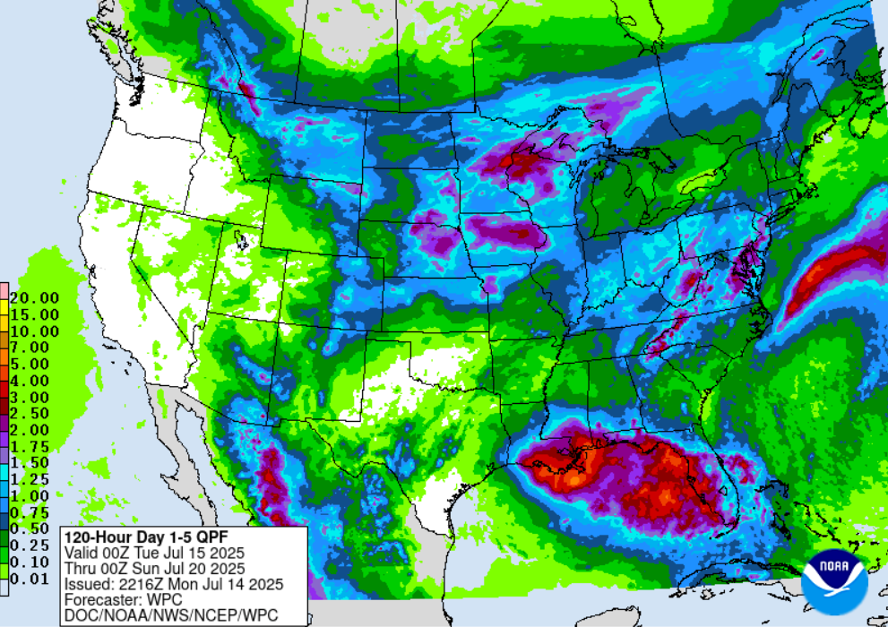
NHC is still monitoring for potential development of a tropical system in the northern Gulf. No local impacts currently expected, but something to watch if you plan on going to the beach. Regardless of a named storm or not – lots of rain expected over the next 5 days along the Gulf coast. Latest tropical updates can be found here: National Hurricane Center
Categories: Featured Blog