
I know I sound like a broken record, but most of the forecast really has been a copy and paste. I promise I’m trying to find different ways to say it so you don’t get too bored.

Over the next 7 days, we continue to deal with our daily Wattery chances – most likely from the late morning thru early evening hours.
Saturday and Sunday have the highest chances (40-60%), but rain is possible daily. You’ll probably squeeze in a few dry days – but with the Wattery, it’s impossible to know which days those are.
No organized severe weather is expected, although we could see a few strong storms, particularly on Sunday – where we could see a storm become briefly severe. Our main threat will be heavy rain, frequent lightning, and gusty winds. No tornado concerns.
Isolated flooding will be possible with any slow-moving cell, or storms that train over the same area. If you encounter a flooded roadway – turn around, don’t drown.
I wish I could give you a better timeframe than “late morning thru early evening” – but that’s just about as specific as I can be with these summertime pop-ups. If you have outdoor plans, stay weather aware and keep an eye on the radar. Have a place to go indoors if thunder roars. If you don’t already have a favorite way to view the radar, consider bookmarking the one we have on our website: Radar | Nashville Severe Weather
We’ll be watching, and as always, will be posting updates to all of our socials.
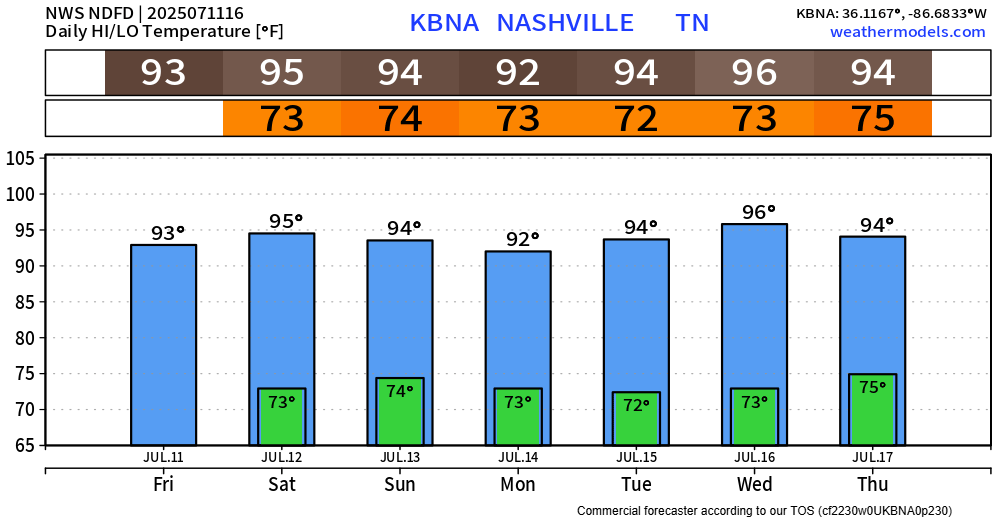
Outside of any showers or storms, temps will be downright hot. Yes, it’s summer, and these temperatures aren’t breaking any records, but it’s still hot. Heat index values up to 105° will be possible. Please, take it easy if you have to be outdoors for long periods of time. Heat illness can set in quickly.
Categories: Featured Blog