
Some areas of fog could develop tonight and be around for your AM commute on Thursday, especially near bodies of water. Be cautious if you encounter any.
Our copy and paste forecast for low to medium Wattery chances throughout the week continue.
Thursday and Friday, chances look quite low. High-res models think most of the activity will reside closer to the Plateau – good news for those looking to get in some dry outdoor plans. Still no promises though.
Unfortunately, chances increase a tad this weekend – meeting the ‘medium’ chance criteria.
Regardless, any day chances will peak during the late morning thru the early evening hours. No severe weather expected, but any storm could drop some heavy rain, lightning and gusty winds. Will still be watching the chance for isolated flooding to occur with any slow-moving storms.
Chances decrease again towards the beginning of next week.
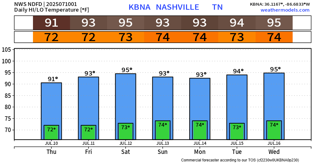
Temperatures will remain hot – but still below any excessive heat criteria. Although it doesn’t take meeting that criteria for heat illness to occur. Heat index values will peak near 100° outside of storms in the afternoon – continue to take it easy if you must be outdoors for long periods of time.
Categories: Featured Blog