
Our hot temps have returned. Although it won’t be as hot as it was a week or so ago, it’ll still be downright hot.
Highs will be in the mid 90s thru Monday before they taper off a bit to the low 90s for the remainder of next week.
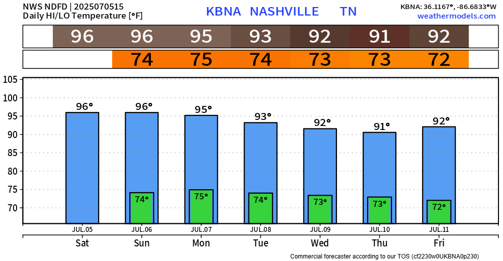
Dew points will be in the low 70s, paired with those high temps = heat index values in the low 100s. Not quite meeting Heat Advisory criteria, but heat illness doesn’t care. Take frequent breaks if you are outdoors for long periods of time, stay hydrated, and watch out for others.
Very low chance for a quick shower or storm Saturday and Sunday. Wattery winners will be few and far between.
Much better chances are introduced Monday, continuing throughout the work week. Medium rain and storm chances will be around, mostly confined to the afternoon and evening. The usual – heavy rain, lightning and gusty winds all possible in any storm.
No way of knowing exactly when and where – but those with outdoor plans should stay weather aware and keep an eye on the radar. If thunder roars – go indoors. Also, will need to keep an eye out for any slow-moving storms, as they could drop a lot of rain in not a lot of time. Be aware of any isolated flooding.
Categories: Featured Blog