We have one more day of our Heat Advisory, which expires at 7p today. Once again, heat index values up to 105° will be possible this afternoon and evening.
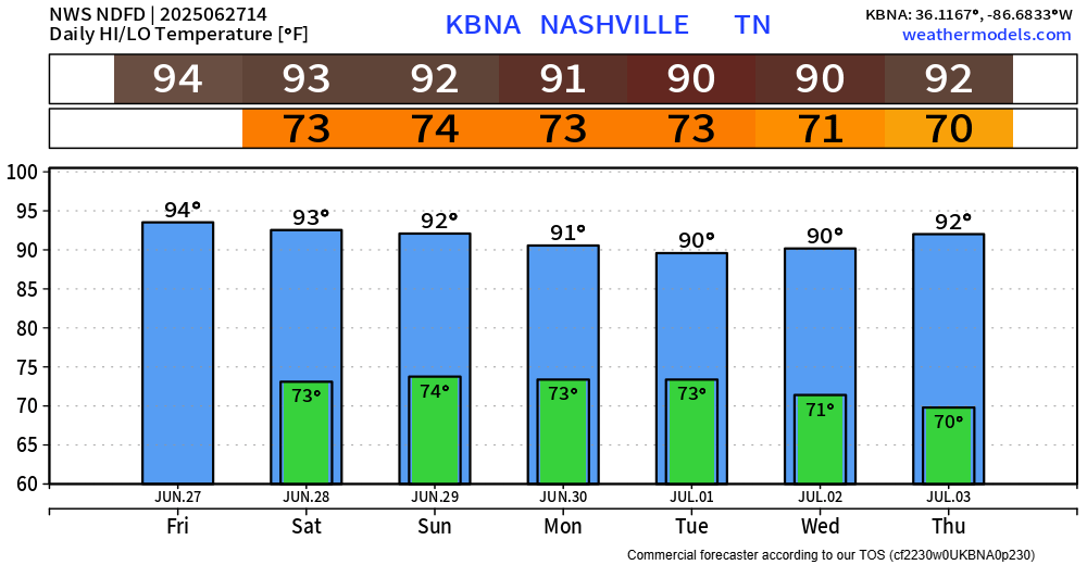
Although it will still be hot this weekend and next week, it just won’t be as hot. It’s still summer, so continue to take it easy if you must be outside for long periods of time. High temperatures continue to be in the low 90s.

Our afternoon and evening Wattery chances begin to increase starting today and will continue to do so thru early next week. Our chances will peak Sunday thru Tuesday, although you could see a storm any afternoon/evening.
With any storm, you could see some heavy rain, frequent lightning and gusty winds. Our atmosphere will be loaded with plenty of moisture over the next several days, and storms won’t be in a rush to move very fast. Beware of isolated flooding, and when thunder roars – go indoors.
It’s impossible to know exactly when and where these storms may pop up at. If you have any outdoor plans, stay connected and weather aware. You can view the radar anytime on our website here: Radar | Nashville Severe Weather
Our rain chances will decrease by mid-next week.
A way too early look at our forecast for the 4th will be hot with low to medium rain chances. A pretty typical forecast. We’ll have to wait a while before we get a look at any of the specifics.
Categories: Featured Blog
