
Outflow boundary that moved thru this morning did a couple of things for us.
- A good bit of Williamson Co. saw heavy rain, a few folks in Davidson. Watch out for any water on roads.
- The outflow boundary cooled things off for everyone, BNA gusted to 36 mph and temps went from 84° to 77°
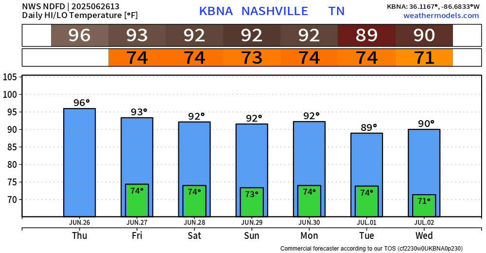
- I think it’s unlikely we hit our projected high temp of 96°, although it will still get hot.
- We still could see an afternoon shower or storm, but chances are still relatively low. But still, any storm could contain heavy rain, lightning and some gusty winds.
The Heat Advisory continues thru 7p Friday. Heat index values could still reach up to 107° today and Friday.
Continue to take it easy if you must be outside for long periods of time. Stay hydrated, take frequent breaks, and look before you lock.
Our high temperatures will relax a bit down into the low 90s this weekend. It will still be hot – just not as hot. Heat index values could still get close to 100°.
Friday afternoon and evening will have our low Wattery chances that we’ve seen the past several days.
Rain chances will increase to around 50-60% starting Saturday and linger thru early next week. Chances will still mostly be confined to the afternoon and evening, but Wattery coverage will be more widespread. Still not expecting any severe weather, but the usual summertime thunderstorms are possible.
Impossible to know exactly when and where these showers and storms might be. If you have outdoor plans this weekend, keep an eye on the radar and have a place to go if a storm comes by.
“It appears that we will be treated to a frontal passage/shortwave passage on Tuesday, so we can expect PoPs [rain chances] to drop off beginning around middle of next week” says NWS Nashville, bringing great news.
Categories: Featured Blog