
Unfortunately, I could copy and paste the blog from yesterday for today. I won’t – but the heat remains brutal.
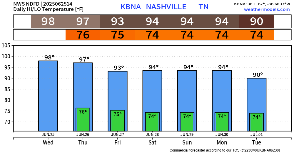
Today and Thursday will likely be the hottest days of the week.
Heat index values (aka “feels like” temps) will again peak near 110° this afternoon.
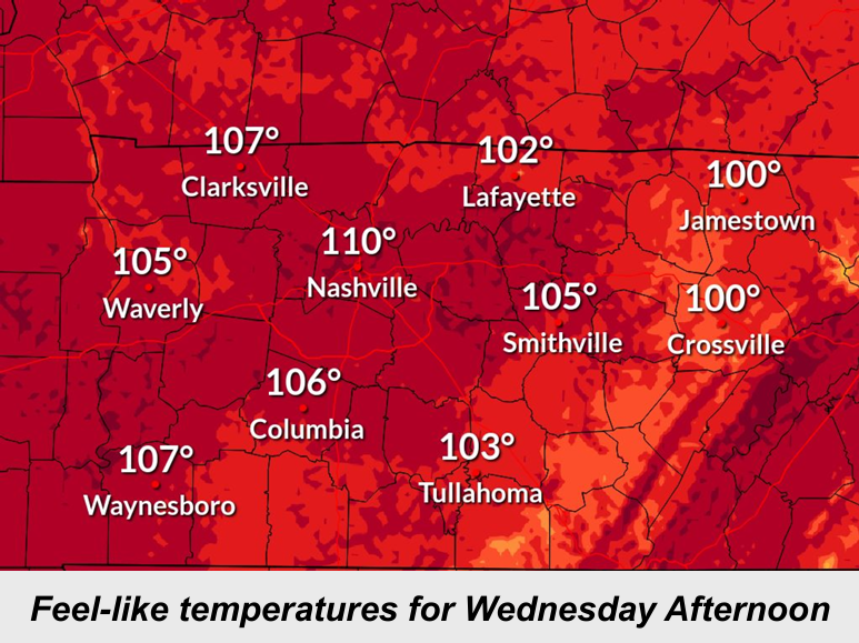
We still have our Heat Advisory that goes thru 7p Friday. Heat index values will be similar each afternoon thru then.
Our actual air temps will be in the upper 90s today and Thursday. I wouldn’t be totally shocked if we briefly hit 100° today if storms avoid the area. Temperatures will relax a bit this weekend – highs will “only” be in the low to mid 90s.
Similar to yesterday, today and Thursday still have a low chance of a quick afternoon shower or storm. You know by now, many will stay dry, but a few folks may see some heavy rain, lightning and gusty winds. Impossible to know exactly when and where, but when thunder roars – go indoors.
Rain chances increase starting Friday and continue into the weekend. Activity will still mostly be confined to the afternoon and evening, but coverage will likely be a bit more widespread than what we’ve seen the past couple of days. Still no severe weather concerns.
Speaking of lightning, NWS Nashville has been participating in Lightning Safety Awareness Week. They’ve been posting some great stuff on their socials this week. I’d encourage you to check it out if you have a chance! Lightning poses a serious danger if you are caught outside in a storm.
Categories: Featured Blog