
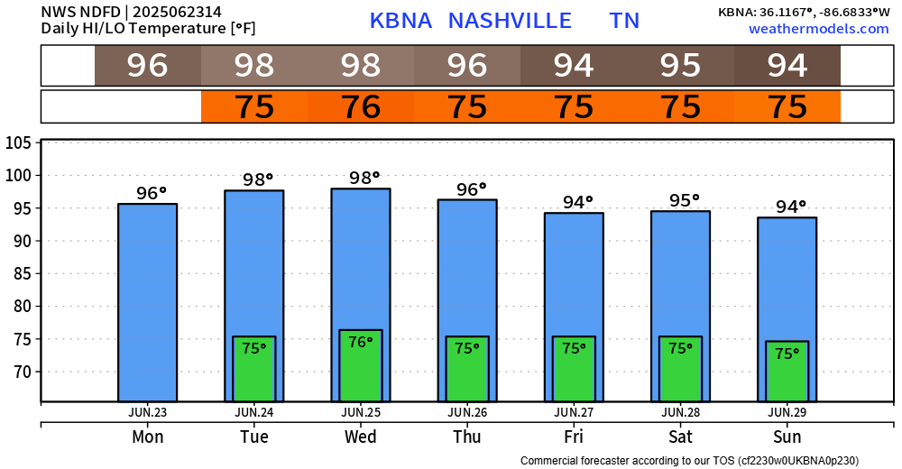
As suspected, NWS Nashville has gone ahead and extended our Heat Advisory until 7p Friday.
Why? Heat index values will reach up to 107° daily.

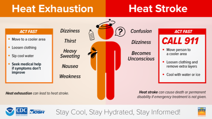
Take precautions if you have to be outdoors for prolonged periods of time.
Stay hydrated, take frequent breaks indoors, wear loose fitting and light-colored clothes, and check in on those who may not have adequate A/C.
High temperatures will reach into the upper 90s, with a low chance of touching 100° by the middle of the week.
Temps will be knocked down slightly this weekend, “only” the mid 90s.
We continue to have the low chance of an afternoon shower or storm to cool things off.
These will be Wattery style, no way of knowing exactly when and where. Some of you may see a good bit of rain, while others see zilch. Example, yesterday folks near Spring Hill saw around 1.5″ of rain, while those close to Franklin (and others) saw 0.00″.
Still not expecting any severe weather, but if any storms do form, they’ll be capable of some heavy rain, lightning and gusty winds before they collapse.
Rain/storm chances increase this weekend to around 30-50% – but still no severe concerns in the forecast.
Categories: Featured Blog