
Side note: we could see some areas of locally dense fog early Friday morning. Take it slow in the morning if you encounter any.
We are currently sitting at the 4th wettest start to the year ever, with BNA recording 35.01″ of rain so far. Your backyard may have seen slightly more/less.
Anyway, we could use a break from the rain – and we finally will get one.
Friday thru at least the beginning of next week should be dry.

However, temperatures will turn up to the hottest they’ve been since last summer.
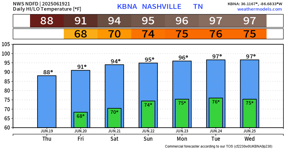
High temperatures will easily make it into the mid 90s by Saturday and stay consistent through at least the middle of next week.
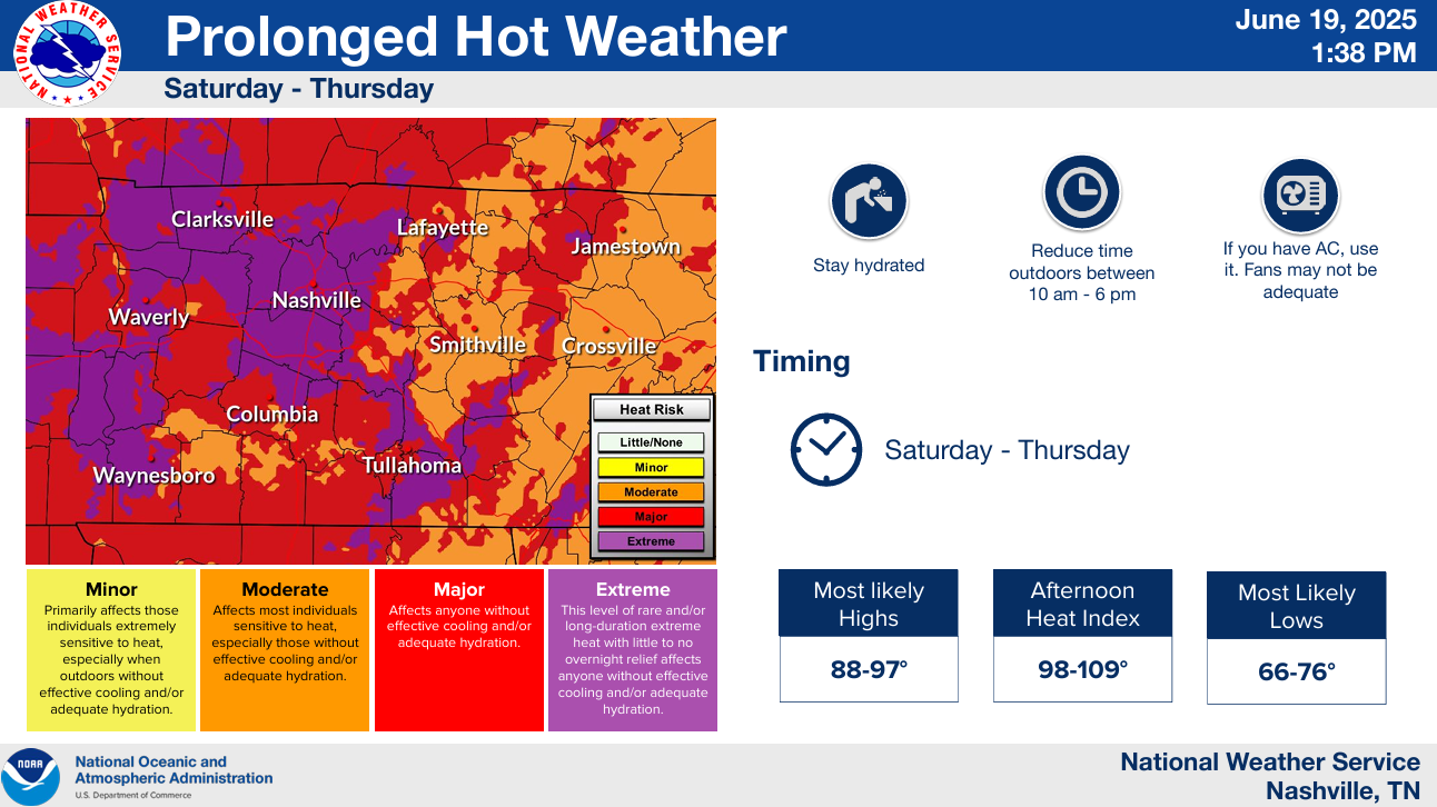
Upper 60s/low 70s dewpoints won’t help out anything – and just make matters worse.
Heat index values will be in the 100-106° range Saturday thru at least Wednesday.
Yes, it is summer. No, these temperatures are not unheard of. But it’s been a while since we’ve experienced temperatures like this.
Stay hydrated, take frequent breaks in the shade (or better A/C), and wear light-colored and loose-fitting clothes.
Categories: Featured Blog