
Just prior to publishing, Davidson Co. have been included in a Severe Thunderstorm Watch until midnight. This does not mean Williamson Co. is in the clear – stay connected! All info in the blog holds true.
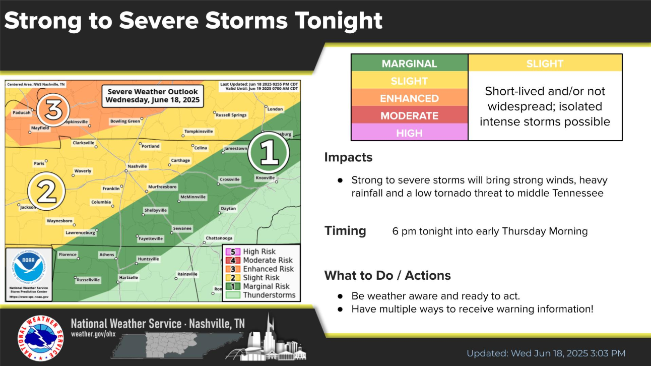
We are dealing with a low threat for severe weather and flash flooding tonight.
Our main concerns will be damaging straight-line winds and heavy rain, with a lesser threat for hail, a tornado.
The most likely timeframe for these strong to severe storms will be 9p to 3a Thursday.
We could see one or more rounds of storms, which will raise the flash flooding threat on top of our already very saturated soils.
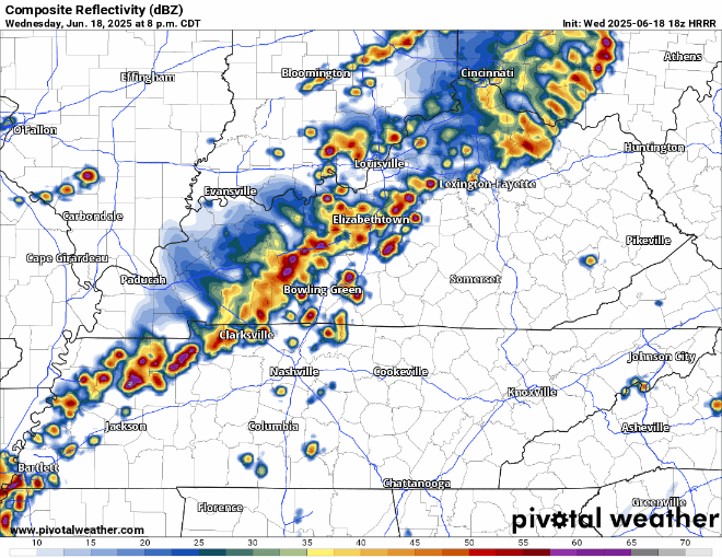
HRRR guesses at how the radar could look like tonight, probably won’t look exactly like this though:
Stay connected and weather aware tonight. Again, this is a relatively a low-end threat – but it’s worth keeping an eye on. Have a way to wake up if a warning is issued for you, whether it’s a NOAA Weather Radio, wake-me-up app on your phone, or the Wireless Emergency Alerts on your mobile phone.
Besides from severe weather, if you live in a flood-prone area, be sure to also pay close attention and have a plan in place if waters start to rise.
We’ll be up watching the storms, sending updates on our socials as needed, and will go live on YouTube if a warning is issued for any portion of our two counties.
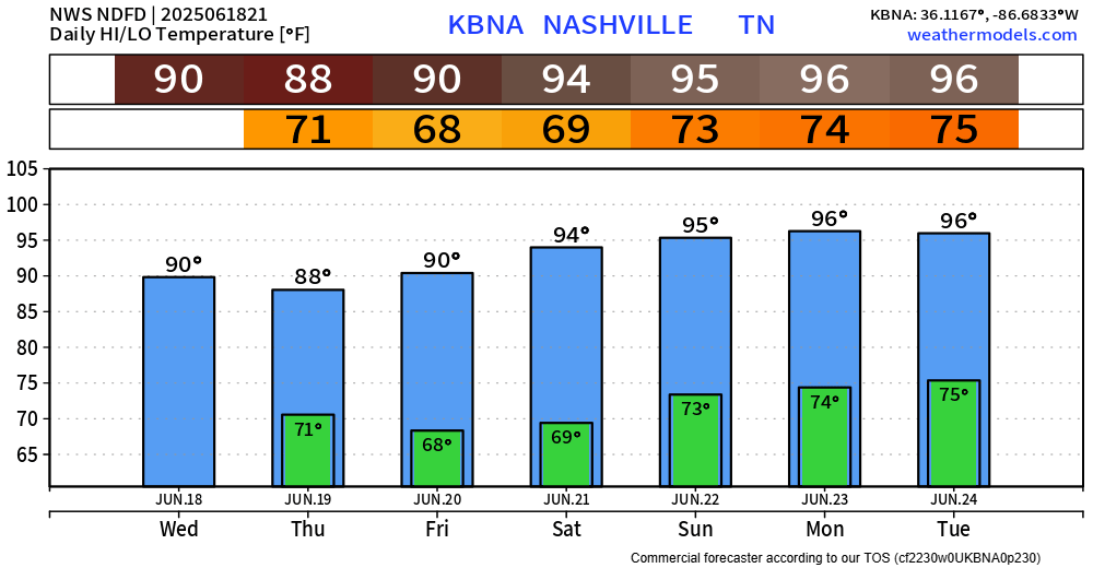
We could see some more showers near sunrise on Thursday, but any severe threat should be long gone.
Models have come down on Wattery chances for Thursday afternoon and evening, but an isolated shower/storm remains possible. Heavy rain, lightning possible – you know the drill.
We will be dry Friday thru at least Sunday, probably lingering into early next week.
However, we will have to deal with the hottest temps so far this year.
High temperatures will easily make it into the mid 90s, dewps will be in the low 70s – this will send heat index values into the 100-105° range Saturday thru at least Tuesday.
Take frequent breaks in the A/C and/or shade if outdoors, stay hydrated and wear light-colored clothing!
Categories: Featured Blog