
I know you’ve heard this one before, but showers/storms continue to move thru our area this evening. Activity should diminish as we get closer to sunset. We’ve seen a ton of rain recently, so creeks will easily fill up with any heavy rainfall. Avoided flooded roadways.
Wednesday during the day it looks like we should be mostly dry. An isolated shower/storm will still be possible during the afternoon but looks like activity will not be as widespread.
Wednesday evening and night is when we’ll have to watch a low-end severe threat.
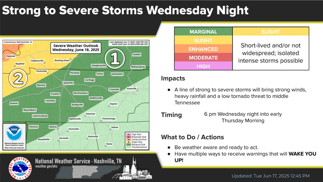
While our main threat will be the potential for strong winds and heavy rainfall, we do have a non-zero threat for a tornado.
The most likely timeframe for severe potential appears to be 6p Wednesday thru 1a Thursday. *This is subject to change.*
Models are fairly confident that a line of strong to severe storms will move thru at some point during this timeframe, although the HRRR is a little slower than other solutions such as the Euro.
Again, this is quite the low-end threat, but it still deserves to be watched. Stay connected for updates, and ensure you have a way to wake up if a warning is issued for you.
We’ll also have the chance to see some additional showers/storms Thursday around sunrise, and again during the afternoon/evening – but storms will likely behave themselves, other than the potential for heavy rain and lightning.
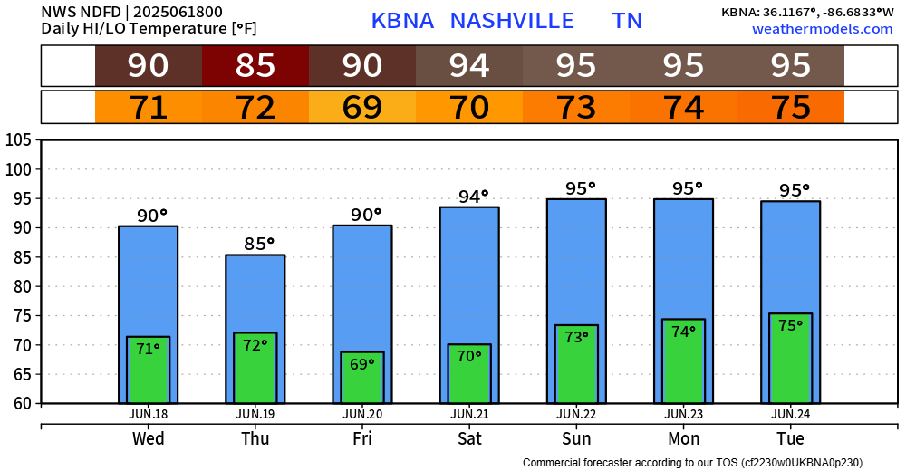
Friday into early next week appear to be dry.

However, temperatures will take this opportunity to turn up to the hottest we’ve seen since last summer.
High temps in the mid 90s and dewps in the low 70s will send heat index values into the 100-105° range Saturday thru at least Tuesday. Something to keep in mind if you have any outdoor plans.
Categories: Featured Blog