
I know I sound like a broken record, but I’m not sure how else to phrase it.
Each day thru at least Thursday will consist of Wattery chances, mostly confined to the afternoon/evening hours.
Impossible to know if plan ‘x’ will be dry at ‘y’ time – just part of the Wattery.
While no one day sticks out for severe potential, any thunderstorm could pulse up and become strong. As always, when thunder roars, go indoors.
Models think today (Saturday) will the higher rain/storm chances compared to Sunday, along with the rest of next week.
If you have any outdoor plans, be sure to keep an eye on the radar, as well as our socials for updates.
If you’ve felt like this is the most rainfall we’ve received thru June 12th since 1979 – you’d be correct.
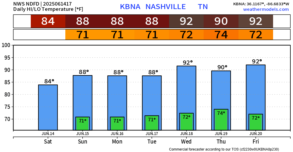
Temps in the upper 80s will warm up to the low 90s by mid next week.
Dewps consistently stay in the low 70s – which really won’t help anything.
Categories: Featured Blog