
Beautiful day ongoing, and this will continue thru the evening. Great night for any outdoor plans, including the closing of the CMAs.
Monday:
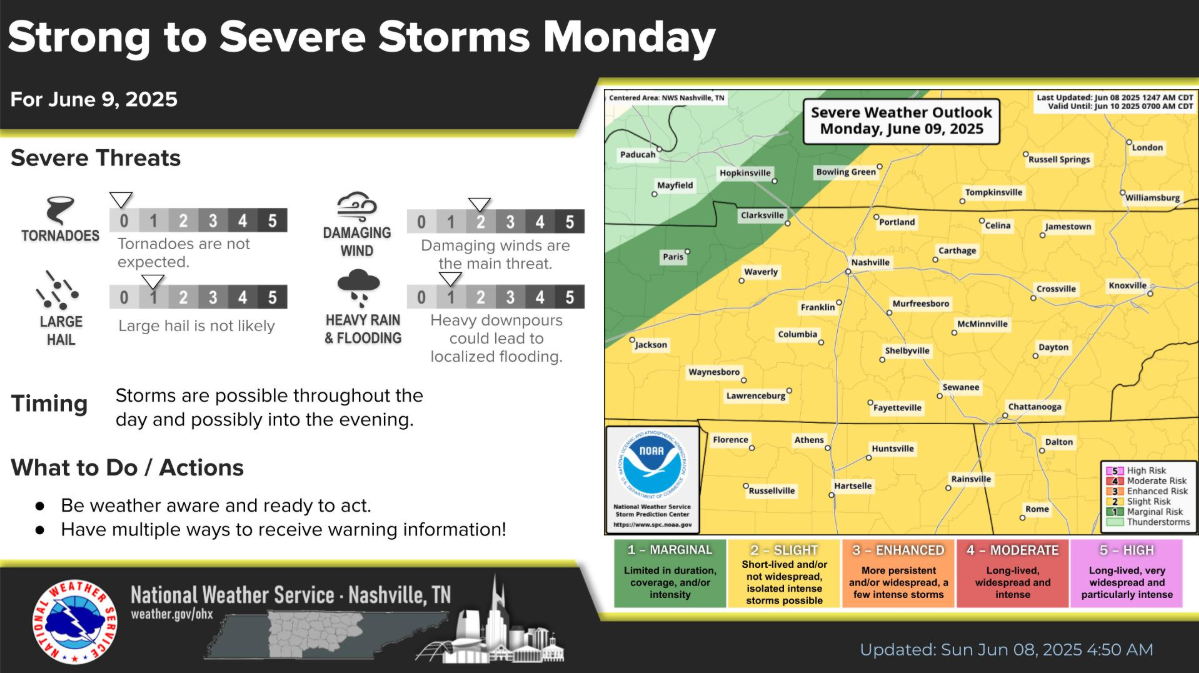
We unfortunately have another day to watch for severe weather.
Our two counties have been placed within the following probabilities of ‘x’ within 25 miles:
- 15% chance of damaging straight-line winds
- 5% chance of hail
- we are not included in any probabilities for a tornado
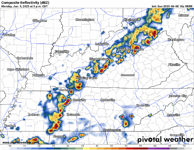
This appears to be another line of potentially strong to severe storms, arriving sometime Monday afternoon/evening.
HRRR model brings the line in here around 3-5p, which sounds like an alright ETA – give or take an hour or two.
No model is perfect, but I think this gives a halfway decent depiction of what the radar could look like.
Damaging straight-line winds will be our main threat, with a lesser chance of some hail. Tornadoes are currently not a concern for tomorrow.
We’ll be keeping an eye on this and will be sending out updates as necessary on all of our socials, along with another blog tomorrow.
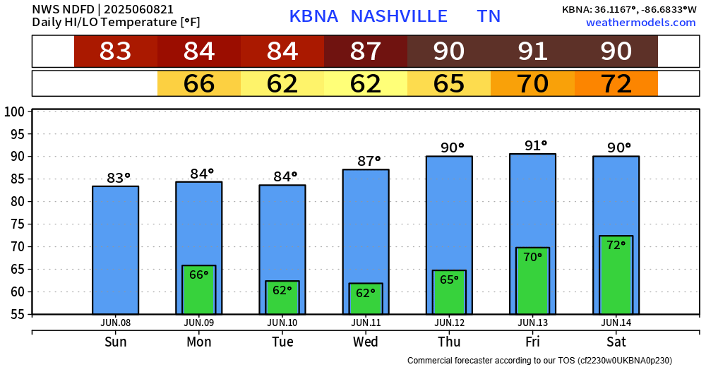
We get a few dry days from Tuesday thru Thursday, before Wattery chances return for Friday, continuing into next weekend.
Temperatures warm up gradually throughout the week.
Categories: Featured Blog