
As of 6p, the radar is mostly clear in Middle TN and think it probably will stay that way throughout the rest of the day. Can’t totally rule a quick popup shower/storm, but most of us likely to stay dry.
Friday and Saturday will really be the main days to stay weather aware, especially if you have outdoor plans (such as CMA Festing).
Both days will have fairly similar setups. We’ll be watching for the potential for maybe a couple Mesoscale Convective Systems (MCS), which are essentially a band of organized storms. These mainly carry the threat for damaging straight-line winds but can also carry a lesser threat for hail and/or a tornado.
Friday:
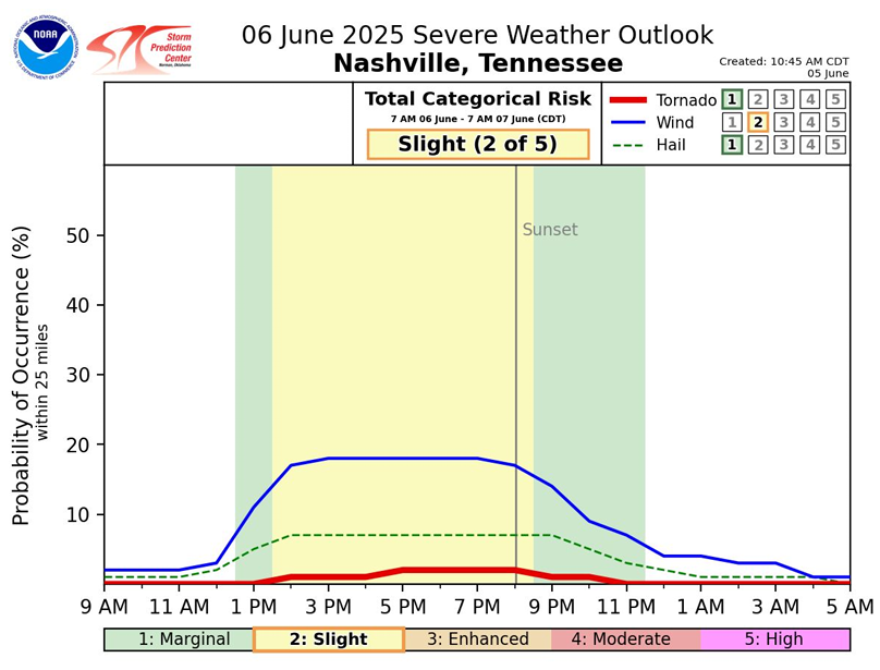
You may have not seen the graphic above before, but I think it does a good job at showing both the main threats, along with the thinking on timing for Friday.
Afternoon/evening looks to be the timeframe to really stay connected and weather aware. Severe threat begins to drop off after sunset.
Damaging straight-line winds will be our main threat, with a much lesser chance for hail and/or a tornado.
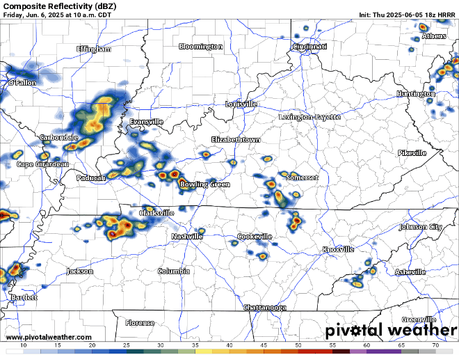
This is just one run of one model, so take it with a grain of salt – but the HRRR thinks we see widespread storm coverage during Friday afternoon, with more scattered showers during the evening.
If you have outdoor plans, including being downtown for the CMAs, it will be important to stay connected for updates. Check back in for our socials, keep an eye on the radar, and know where you can duck indoors if a storm is headed for you.
Saturday:
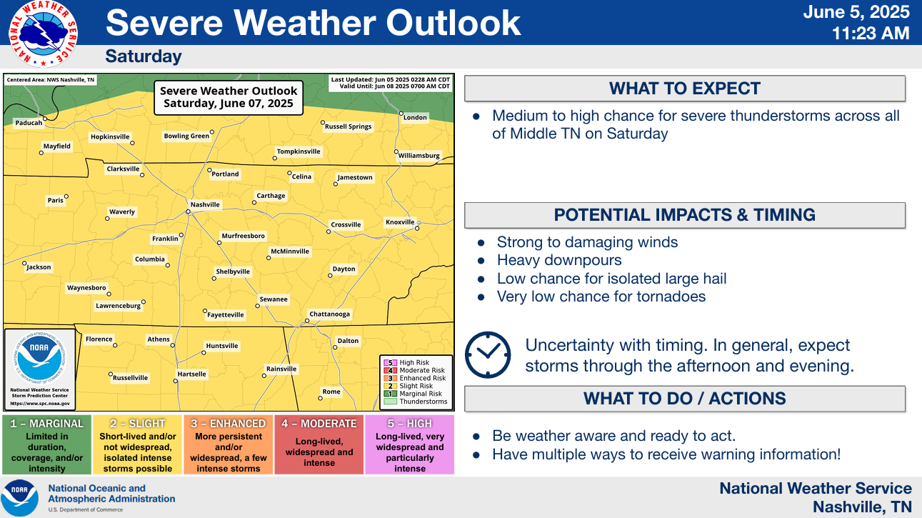
Saturday looks very similar to Friday.
Same afternoon/evening timeframe, with damaging straight-line winds being the main threat.
Impossible to get any more specific than that timeframe, just with the potential scattered nature of the storms. We’ll keep you posted with any additional information.
Sunday:
“By Sunday, a shortwave passing through will push the stationary front through Middle TN which pushes the bulk of thunderstorm activity to our south and east. This unfortunately doesn`t mean that we`re totally in the clear as far as rain goes, but it does push our highest rain chances Sunday to areas south of I-40 and across the Plateau” says NWS Nashville.
So lesser chances but still could see some rain up thru the early evening hours. But looks much better than say Friday or Saturday.
I imagine there will be lots of questions about going to the CMA Fest. Regardless of what day(s) you are going, staying connected and weather aware will be important. Know where the closest enclosed structure is if a storm is headed your way. This can be applied to all with any outdoor plans!
We’ll be sending out updates on all of our socials as needed and will have daily blog posts – as always. We will go live on our YouTube channel if a warning is issued for any portion of our two counties.
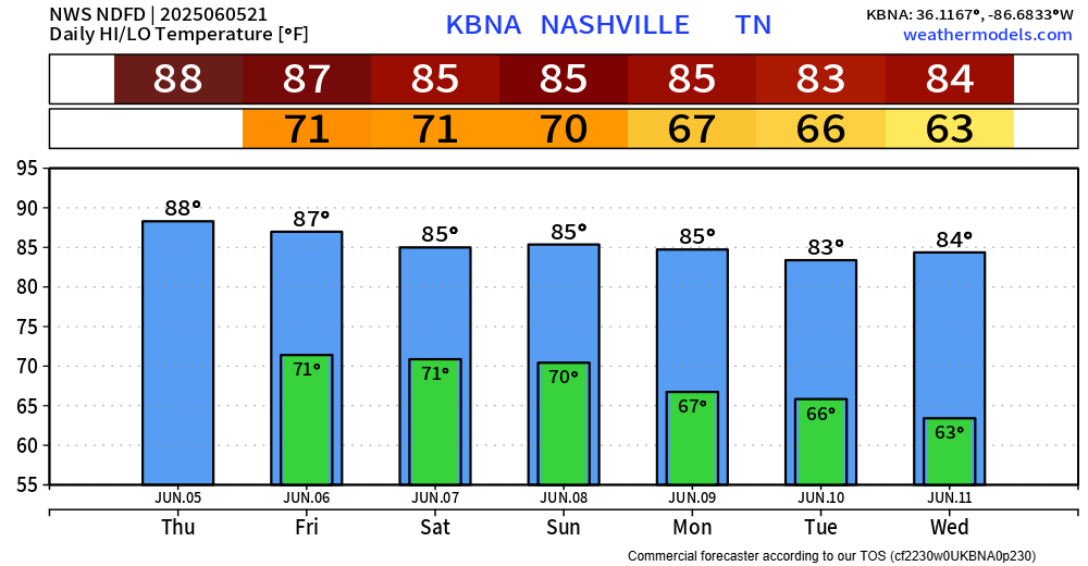
Temperatures will be very early June like. Dewpoints in the low 70s will help it feel muggy.
Categories: Featured Blog