
This evening will be the last evening for a good bit without rain chances, enjoy it!
Quite a bit to talk about over the next several days. Think the easiest way to go about this will be to be break it down day by day.
Thursday:
Rain/storm chances return, although coverage won’t be too widespread, PoPs are only at around 40%.
Most likely during the afternoon/evening. Impossible to get any more specific than that due to scattered nature of showers/storms, which will be a common theme over the next several days.
Below are two different model depictions of what the radar could look like 4p on Thursday. Both could be totally off.
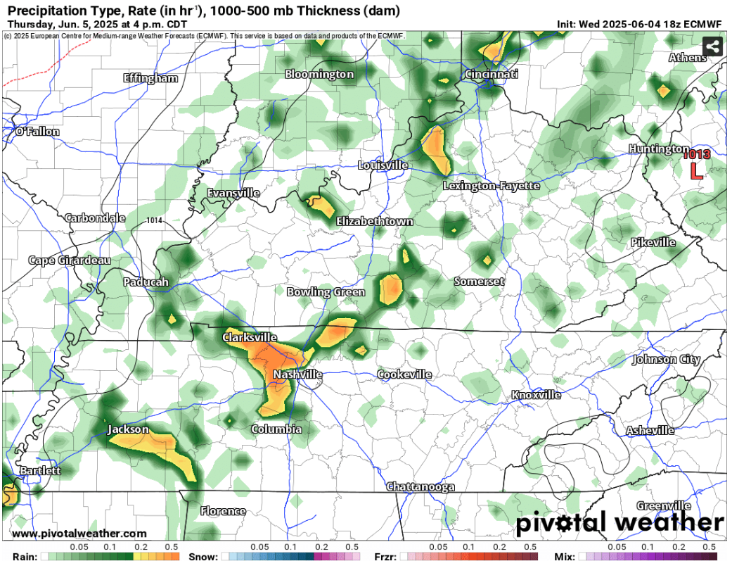
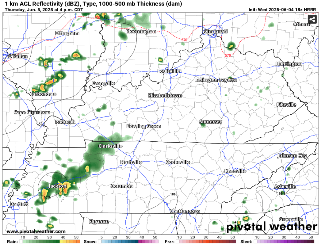
While any thunderstorm could contain heavy rain and lightning, one or two storms could be on the stronger side containing damaging straight-line winds.
If you have any outdoor plans, keeping rain gear and a radar handy will be very useful. We’ll be sending out any updates as needed to our socials.
Friday:
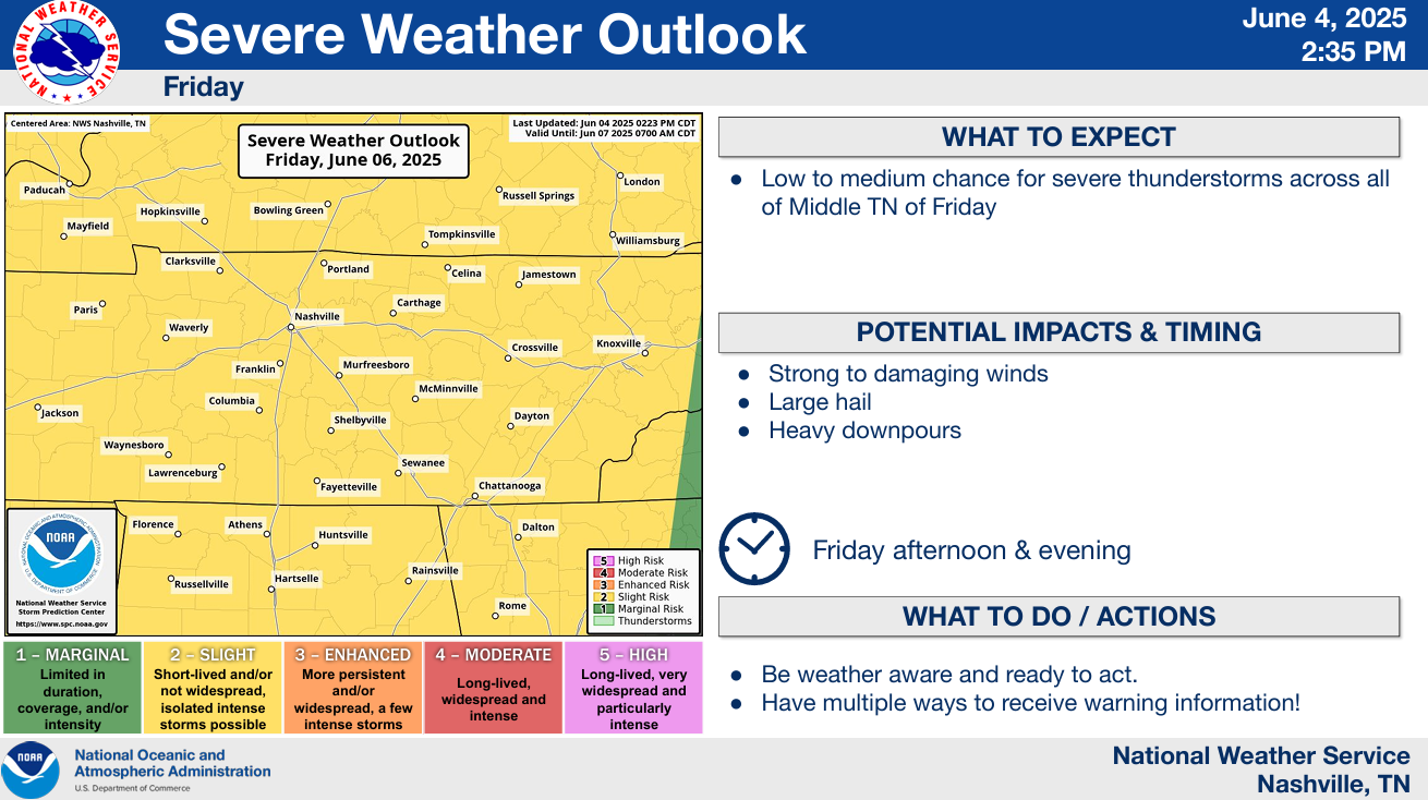
For Friday, both of our two counties (along with most of TN) are outlooked with a 15% chance of severe weather within 25 miles.
Again, timing wise this appears to most likely be in the afternoon & evening, with the main threats being damaging straight-line winds and large hail. For now, models think we lack all of the ingredients for tornadoes – but something to watch.
While yet again we could see some scattered storms in the afternoon, some models are hinting at the possibility of an MCS (Mesoscale Convective System, aka an organized line of storms) sometime Friday PM – enhancing the risk of some damaging straight-line winds. Models are not very good at handling these types of systems this far out, and while it will be something to watch, confidence is low in such solution.
Saturday:
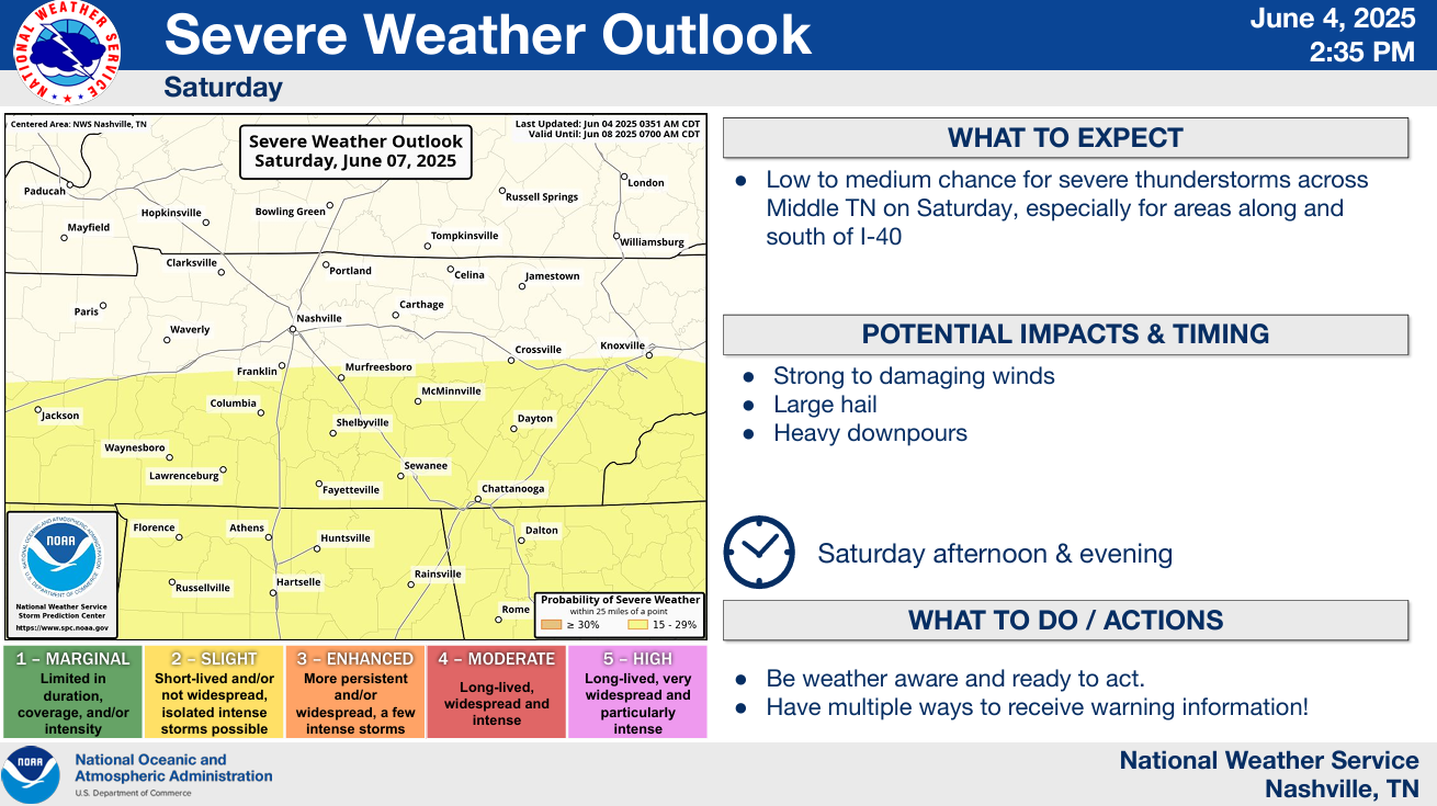
Saturday places along and S of 840 are outlooked with a 15% chance of severe weather within 25 miles, although try not to pay too much attention to exactly where the line is drawn – it will likely change.
Same deal as Friday really, afternoon/evening – scattered showers/storms, some could be strong to severe.
Confidence will increase as we get closer.
Sunday:
Rain/storm chances finally relax a bit, although some isolated showers/storms will still be possible in the afternoon/evening timeframe – but overall coverage should be lower than Friday and Saturday.
Takeaways:
- If you have outdoor plans (cough, cough CMA-goers), having rain gear handy, staying weather aware, and having an enclosed shelter nearby is your safest bet.
- Friday and Saturday have the highest rain chances, although no single day looks like a complete washout.
- Patterns like this can be challenging for models, stay connected for any changes to the forecast!
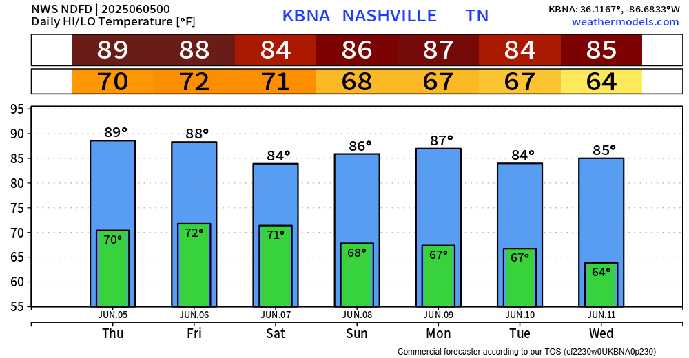
Temperatures throughout all of this will be warm to borderline hot.
Categories: Featured Blog