
We are currently on our way towards 90°, we’ll likely get there but could end up just short. If we do get there, it’ll be the first time since October 6th of last year.
And if we don’t get there today, we have another go at it Wednesday.

Temperatures will stay fairly steady over the next week, pretty close to average.
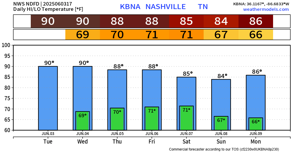
Our brief dry streak will likely end on Thursday, with chances continuing thru at least Sunday.
Friday and Saturday carry the highest rain chances (60-75%), with lesser chances the other two days (~40%).
Most likely timeframe for rain/storms will be afternoon/evening. Can’t really get any more specific than that due to the scattered, random nature of the cells.
While thunderstorms will be possible daily (per usual in these Wattery-type set ups), the Storm Prediction Center has introduced a 15% probability of severe weather within 25 miles for us on Friday.
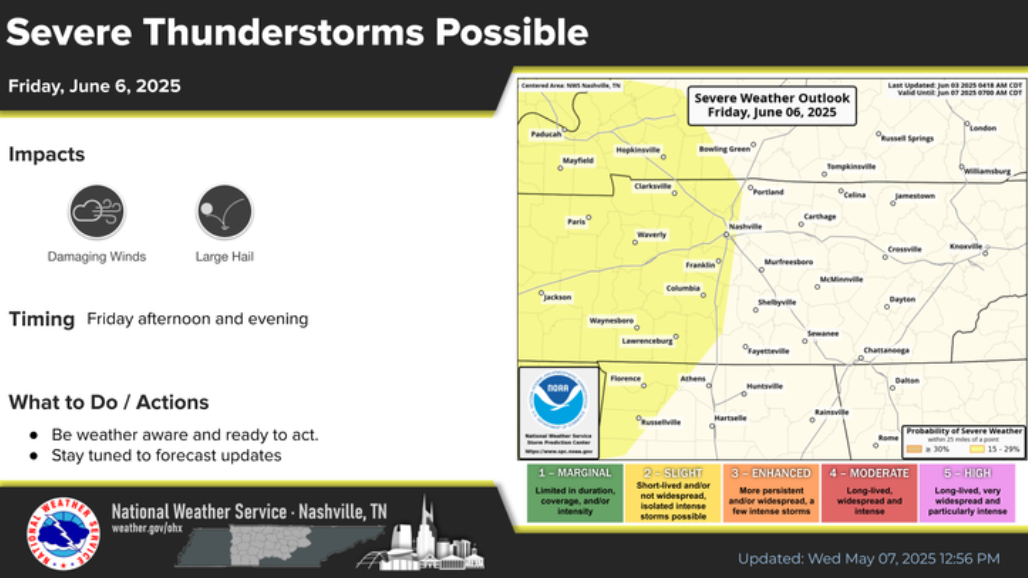
As of right now, damaging straight-line winds and large hail appear to be the main threats. This is all still several days away and will be something to monitor – as things can, and likely will change between now and then.
Stay connected, especially you, CMA-goers.
Categories: Featured Blog