
If you feel like May has been wetter than normal – you’d be correct.
The wettest May in 15 years, and we’ll add some to that total as we wrap up the month.
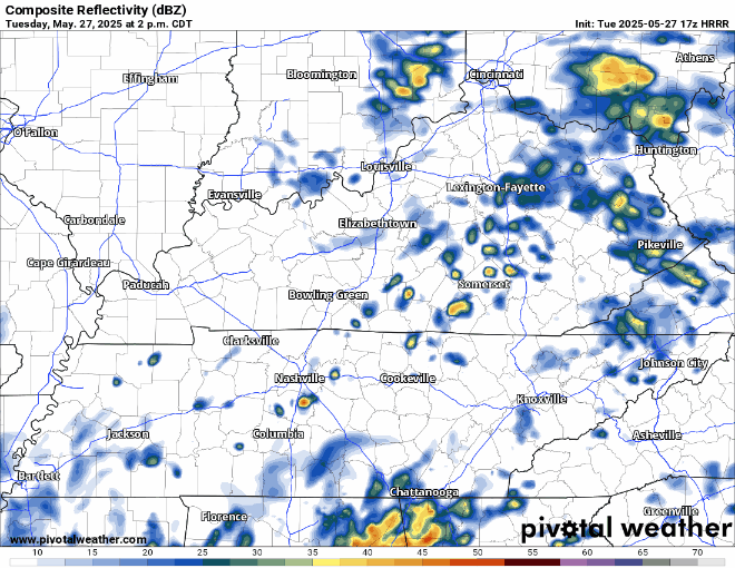
Rain chances will continue this afternoon and evening. Scattered showers/thunderstorms possible, not a total washout – but heavy rain possible underneath a storm.
Lower rain chances exist Wednesday, with spotty showers possible during the afternoon. Some of us stay dry.
Models have upped rain chances during the Thursday PM – Friday AM timeframe.
“Forecast rain totals have also trended up to an additional 0.50 to 1 inch Thursday through Friday. Which by itself would not a concern, but with it falling on already saturated soils, a low flooding risk may persist through the end of the week. Fortunately, don`t see much of a severe risk at this time with little instability and saturated forecast soundings.” – quote from the great minds at NWS Nashville.
Hard right now to get any more specific on timing due to model discrepancy, confidence will increase as we get closer.
Our rain chances finally subside Friday night going into Saturday. Leaving us with at least a short break from any rain chances.
Low rain/storm chances return Sunday afternoon.
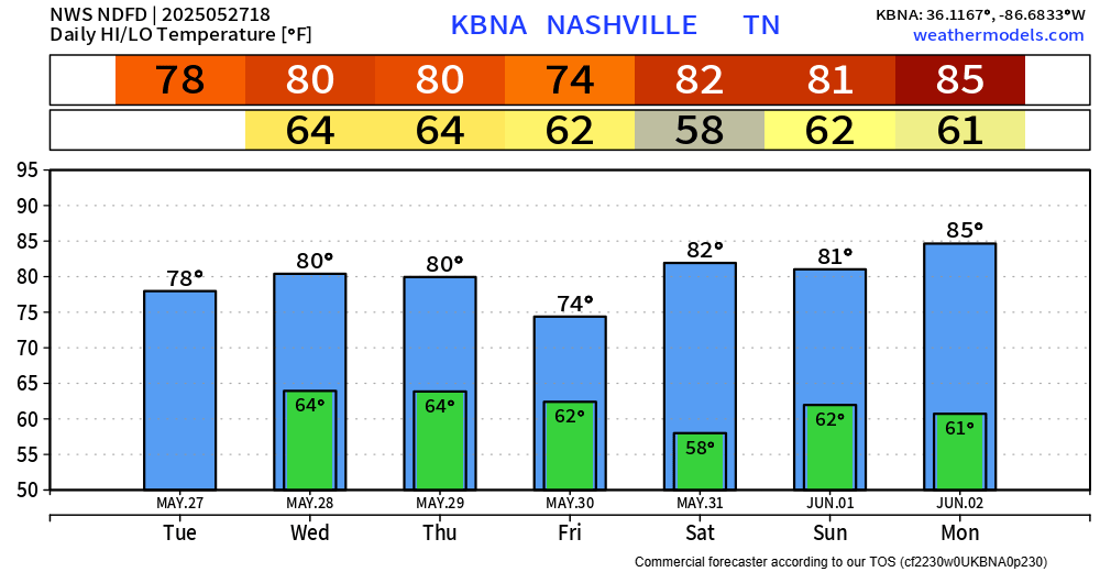
Temperatures remain slightly below-average as we end May, heating up towards the beginning of June. Long-range models think we get closer to 90° during the first 10-ish days of June.
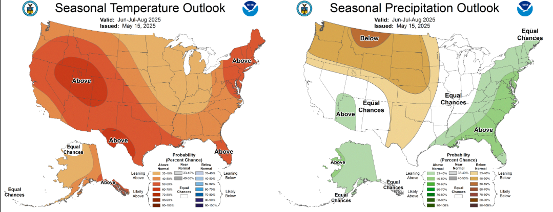
Is this cooler/wetter May a preview of our summer, or will we see a hotter and drier pattern return?
The outlook for June, July and August from the Climate Prediction Center gives us “Equal Chances” of above or below average precipitation, a 33-40% chance of above average temperatures. Sounds like Summer.
Categories: Featured Blog