
While Saturday doesn’t look like a complete washout, our stretch of nice and dry days will come to an end.
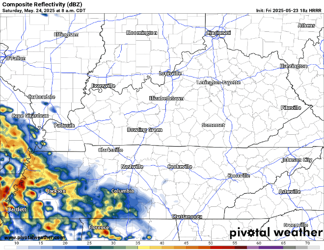
The HRRR and Euro are in fairly good agreement on how tomorrow plays out – I’ll show the HRRR for high-res sake.
Off/on rain chances possible starting late morning lasting thru the evening – majority of the heavy rain misses us to the SW. Think your run to the farmer’s market and any nighttime plans will be dry, but anything in-between might be wet.
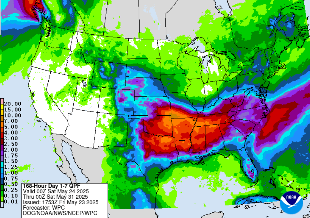
Sunday and Monday look fairly similar. High rain chances both days, with some rumbles of thunder possible. Chances peak from about midday thru the evening both days.
Rain chances for Tuesday have come up a bit, with chances hanging around all day according to models.
Mid-week precip chances come down a bit but still exist.
Severe chances? Not really. We might see a strong storm on Sunday or Monday – but think most storms remain fairly tamed. Some rumbles of thunder certainly possible though. If thunder roars – head indoors and out of the pool/lake.
Rainfall totals over the next week will generally end up in the 3 to 4” range. This will be spread out enough to avoid any real flooding concerns. May is normally our second rainiest month of the year (just behind April), and we are already above-average on rainfall so far this year.

Categories: Featured Blog